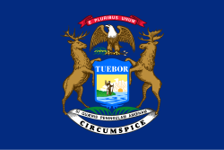
Michiganterritoriet
| Michiganterritoriet | ||||
| Michigan Territory (Engelska) | ||||
| ||||
| Huvudstad | Detroit | |||
| Språk | Engelska | |||
| Religion | kristendom | |||
| Bildades | 1805 | |||
| – bildades genom | lagstiftning | |||
| – bildades ur | Indianaterritoriet | |||
| Upphörde | 1836 | |||
| – upphörde genom | delning | |||
Michiganterritoriet (engelska: Michigan Territory) var ett amerikanskt federalt territorium, som existerade från 30 juni 1805 till 26 januari 1837, varefter kvarstående områden uppgick i den amerikanska delstaten Michigan.[1] Detroit var huvudstad.
Bildande 1805
Michiganterritoriet bildades 1805 genom att ett område, nästan motsvarande dagens Michigan, bröts ur Indianaterritoriet.
Utvidgning 1818
När Illinois bildades 1818, av de södra delarna av Illinoisterritoriet, överfördes resterande delar till Michiganterritoriet. Ett mindre område överfördes samtidigt från Michiganterritoriet till Indiana, så att den sistnämnda staten fick tillträde till Lake Michigan.
Utvidgning 1833
År 1833 överfördes det område som hade tillhört Louisianaköpet, och som låg norr om Missourifloden och öster om denna flod och White Earth River, till Michiganterritoriet. Det motsvarar i stort sett de östra delarna av nuvarande North Dakota och South Dakota, de västra delarna av nuvarande Minnesota, samt Iowa. I Michiganterritoriet i sin helhet ingick då de nuvarande delstaterna Michigan, Wisconsin, Iowa, Minnesota och stora delar av North och South Dakota.
Toledo Strip 1835
Inför bildandet av staten Michigan, uppstod en konflikt mellan den blivande staten och staten Ohio om gränsområdet mellan den sistnämnda staten och Michiganterritoriet. Det omtvistade området överfördes till Ohio, mot att den blivande staten skulle få sig tilldelat hela den övre halvön, Upper Peninsula, mellan Lake Superior och Lake Michigan.
Delning 1836
Inför staten Michigans bildande, delades Michiganterritoriet 1836, så att de delar som inte skulle ingå i den nya staten bildade det nya Wisconsinterritoriet. De kvarvarande delarna av Michiganterritoriet bildade 1837 staten Michigan.
Källor
- Den här artikeln är helt eller delvis baserad på material från engelskspråkiga Wikipedia, 25 april 2013.
Fotnoter
- ^ ”Michigan” (på engelska). World Statesmen. http://www.worldstatesmen.org/US_states_L-M.html#Michigan. Läst 20 juli 2015.
Media som används på denna webbplats
Författare/Upphovsman: Jengod, Licens: CC BY 2.0
Map of en:Michigan Territory from 1805 until 1818; created October 2004 by Jengod.
Författare/Upphovsman: Wikipedia uploader was Hotstreets at en.wikipedia, Licens: CC BY-SA 3.0
Modified from Upper Peninsula picture. GNU Public. Shows the territory traded from Wisconsin Territory to Michigan as a result of the en:Toledo War. Used pics from en:Upper Peninsula of Michigan, and source of http://www.sos.state.mi.us/history/museum/explore/museums/hismus/prehist/settling/images/maptole.gif from the State of Michigan.
Författare/Upphovsman: Drdpw, Licens: CC BY-SA 3.0
Map showing the formerly disputed area of northwest Ohio known as the Toledo strip.
Författare/Upphovsman: Jengod, Licens: CC BY 2.0
Map of en:Michigan Territory from 1833 until 1836; created October 2004 by Jengod.
Based on a public domain U.S. government map.Digital reproduction of the Star Spangled Banner Flag, the 15-star and 15-stripe U.S. garrison flag which flew over Fort McHenry following the Battle of Baltimore in the War of 1812. Seeing the flag during the battle, and again the following morning, inspired Francis Scott Key's song The Star-Spangled Banner, now the U.S. national anthem. During the battle a smaller "storm flag" was flown; it was replaced by this larger flag early the next morning, which is the flag Key saw then. This larger flag is now displayed at the National Museum of American History in Washington, D.C. For several decades it remained in the family of Fort McHenry's commanding officer, before being given to the Smithsonian in 1912. The family cut pieces out of the flag from time to time as gifts.
The original flag was 42 feet long and 30 feet high, with each stripe being about two feet, and the stars being about two feet in diameter. It was made by Mary Young Pickersgill and her assistants. More info on the original dimensions here. The stars seem to mostly point to the side, except for one (the bottom right) which points down. One star has been cut out of the actual flag, so I'm guessing that originally pointed to the side as well (Fort McHenry flies a flag (File:Ft mchenry 15starflag.jpg) with a similar star pattern, but it looks like they are all to the side, and the other dimensions look similar to a modern flag). I guesstimated other dimensions and star positions based on File:Star-Spangled-Banner-1908-1919.jpg; the union (blue area) looks to be about 19 feet wide. The star rows look to be evenly distributed; i.e. the distance between the top/bottom edges and the center of a star row looks to be about the same as the distance between two (centers of) rows. Not so left-to-right; they are pretty close to the right edge and even closer to the hoist side. Also available here, page 12.Författare/Upphovsman: Jengod, Licens: CC BY 2.0
Map of Michigan Territory in 1836 following the detachment of Wisconsin Territory Based on a public domain U.S. government map.
Författare/Upphovsman: jengod, Licens: CC BY 2.0
Map of en:Michigan Territory from 1818 until 1833; created in October 2004 by en:User:jengod.


