Mesquite, Nevada
| Mesquite | |
| Stad (city) | |
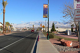
(c) Stan Shebs, CC BY-SA 3.0 Huvudgatan i Mesquite | |
| Land | |
|---|---|
| Delstat | |
| County | Clark County |
| Höjdläge | 488 m ö.h. |
| Koordinater | 36°48′13″N 114°4′2″V / 36.80361°N 114.06722°V |
| Area | 83,47 km² (2020)[1] |
| - land | 82,27 km² (2020) |
| - vatten | 1,2 km² (2020) |
| Folkmängd | 20 471 (2020)[2][3] |
| Befolkningstäthet | 249 invånare/km² |
| Grundad | 1880 |
| Tidszon | PST (UTC-8) |
| - sommartid | PDT (UTC-7) |
| ZIP-kod | 89027 |
| Riktnummer | 702 och 725 |
| GNIS-kod | 842060 |
| Geonames | 5508180 |
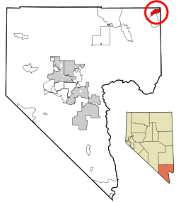
Mesquite i Clark County och Nevada | |
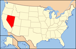
Nevadas läge i USA | |
| Wikimedia Commons: Mesquite, Nevada | |
| Webbplats: https://www.mesquitenv.gov | |
| Redigera Wikidata | |
Mesquite är en stad (city) i Clark County i delstaten Nevada i USA. Staden hade 20 471 invånare, på en yta av 83,47 km² (2020).[4][5]
Referenser
- ^ Gazetteer Files – 2020 (på engelska), United States Census Bureau, läs online, läst: 20 december 2021.[källa från Wikidata]
- ^ Explore Census Data – Mesquite city, Nevada (på engelska), United States Census Bureau, läs online, läst: 20 december 2021.[källa från Wikidata]
- ^ United States Census Bureau (red.), USA:s folkräkning 2020, läs online, läst: 1 januari 2022.[källa från Wikidata]
- ^ ”Explore Census Data – Mesquite city, Nevada” (på engelska). United States Census Bureau. https://data.census.gov/cedsci/profile?g=1600000US3246000. Läst 20 december 2021.
- ^ ”Gazetteer Files – 2020” (på engelska). United States Census Bureau. https://www.census.gov/geographies/reference-files/time-series/geo/gazetteer-files.2020.html. Läst 20 december 2021.
Externa länkar
 Wikimedia Commons har media som rör Mesquite.
- Officiell webbplats
| ||||||||||
Media som används på denna webbplats
Flag of the State of Nevada. The flag is described in Nevada Revised Statutes Chapter 235, Sec. 20 as follows: The body of the flag must be of solid cobalt blue. On the field in the upper left quarter thereof must be two sprays of Sagebrush with the stems crossed at the bottom to form a half wreath. Within the sprays must be a five-pointed silver star with one point up. The word “Nevada” must also be inscribed below the star and above the sprays, in a semicircular pattern with the letters spaced apart in equal increments, in the same style of letters as the words “Battle Born.” Above the wreath, and touching the tips thereof, must be a scroll bearing the words “Battle Born.” The scroll and the word “Nevada” must be golden-yellow. The lettering on the scroll must be black-colored sans serif gothic capital letters.
This map shows the incorporated areas in Clark County, southern Nevada.
- Highlighting Mesquite in red.
- Credits
- I created it in Inkscape using data from the following files: Census 2000 Block Map - Clark County (PDF) and Southern Nevada Public Lands Management Act Map (PDF)
Författare/Upphovsman: This version: uploader
Base versions this one is derived from: originally created by Wapcaplet, Licens: CC BY 2.0
Locator map of Nevada — in the Western United States.


