McKinley County
| McKinley County | |
| County | |
McKinley Countys domstolshus i Gallup. | |
| Land | |
|---|---|
| Delstat | |
| Huvudort | Gallup |
| Största stad | Gallup |
| Area | 14 129 km² (2010)[1] |
| - land | 14 115 km² (100%) |
| - vatten | 14,2 km² (0%) |
| Folkmängd | 71 492 (2010)[2] |
| Befolkningstäthet | 5,1 invånare/km² |
| Grundat | 1899 |
| - uppkallat efter | William McKinley |
| Tidszon | MST (UTC-7) |
| - sommartid | MDT (UTC-6) |
| FIPS-kod | 35031 |
| Geonames | 5478585 |
Läge i delstaten New Mexico. | |
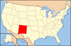
Delstatens läge i USA. | |
| Fotnoter: Naco - Find a county | |
McKinley County är ett administrativt område i delstaten New Mexico, USA. År 2010 hade countyt 71 492 invånare. Den administrativa huvudorten (county seat) är Gallup.
Geografi
Enligt United States Census Bureau har countyt en total area på 14 128 km². 14 112 km² av den arean är land och 16 km² är vatten.
Angränsande countyn
- San Juan County, New Mexico - nord
- Sandoval County, New Mexico - öst
- Cibola County, New Mexico - syd
- Apache County, Arizona - väst
Orter
- Black Rock
- Brimhall Nizhoni
- Church Rock
- Crownpoint
- Crystal
- Gallup (huvudort)
- Nakaibito
- Navajo
- Pueblo Pintado
- Ramah
- Rock Springs
- Thoreau
- Tohatchi
- Tse Bonito
- Twin Lakes
- Yah-ta-hey
- Zuni Pueblo
Källor
- ^ ”2010 Census U.S. Gazetteer Files for Counties”. U.S. Census Bureau. Arkiverad från originalet den 5 juli 2012. https://www.webcitation.org/68vYLbou5?url=http://www.census.gov/geo/www/gazetteer/files/Gaz_counties_national.txt. Läst 5 juli 2012.
- ^ ”State & County QuickFacts, McKinley County, New Mexico” (på engelska). U.S. Census Bureau. Arkiverad från originalet den 14 juli 2011. https://www.webcitation.org/60B5Apv4S?url=http://quickfacts.census.gov/qfd/states/35/35031.html. Läst 6 juli 2011.
| ||||||||||
Media som används på denna webbplats
Författare/Upphovsman: This version: uploader
Base versions this one is derived from: originally created by en:User:Wapcaplet, Licens: CC BY 2.0
Map of USA with New Mexico highlighted
McKinley County (New Mexico) courthouse, located at 207 W. Hill Avenue in Gallup, New Mexico.


