Matoury
| Matoury | |
| Kommun | |
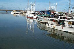
Hamnen Larivot i Matoury | |
| Land | |
|---|---|
| Region | Franska Guyana |
| Departement | Franska Guyana |
| Arrondissement | Cayenne |
| Koordinater | 4°50′59″N 52°19′37″V / 4.84972°N 52.32694°V |
| Yta | 137,19 km²[1] |
| Folkmängd | 34 810 ()[2] |
| Befolkningstäthet | 254 invånare/km² |
| Tidszon | GFT (UTC−3) |
| - sommartid | Ingen |
| Postnummer | 97351 |
| INSEE | 97307 |
| Geonames | 3380965 |
| OSM-karta | 1663798 |
Kommunens läge i Franska Guyana | |
| Webbplats: http://www.mairie-matoury.fr | |
Matoury är en kommun i det franska utomeuropeiska departementet Franska Guyana i Sydamerika. År 2021 hade Matoury 34 810 invånare.
Befolkningsutveckling
| Befolkningsutvecklingen i Matoury 1990–2021[3] | ||||
|---|---|---|---|---|
| År | Folkmängd | |||
| 1990 | 10 152 | |||
| 1999 | 18 032 | |||
| 2007 | 24 893 | |||
| 2015 | 32 427 | |||
| 2021 | 34 810 | |||
Se även
Referenser
- ^ Répertoire géographique des communes, Institut national de l'information géographique et forestière, läst: 26 oktober 2015.[källa från Wikidata]
- ^ Populations légales 2021, Institut National de la Statistique et des Études Économiques, 28 december 2023.[källa från Wikidata]
- ^ ”Historique des populations légales – Recensements de la population 1968–2021” (på franska). www.insee.fr. Institut national de la statistique et des études économiques (INSEE). 28 december 2023. https://www.insee.fr/fr/statistiques/2522602. Läst 22 augusti 2024.
Externa länkar
 Wikimedia Commons har media som rör Matoury.
| |||||||
Media som används på denna webbplats
Författare/Upphovsman: The original uploader was Didwin på franska Wikipedia., Licens: CC BY-SA 2.5
description:port de Larivot auteur : didwin
Författare/Upphovsman: Tschubby, Licens: CC BY-SA 3.0
Lage der Gemeinde Matoury
Författare/Upphovsman: Carole Mathée, uploaded by Germenfer, Licens: CC BY-SA 4.0
Local flag used by the the Regional Government of the Territorial Collectivity of French Guiana.


