Maseru (distrikt)
| Den här artikeln har skapats av Lsjbot, ett program (en robot) för automatisk redigering. (2016-10) Artikeln kan innehålla fakta- eller språkfel, eller ett märkligt urval av fakta, källor eller bilder. Mallen kan avlägsnas efter en kontroll av innehållet (vidare information) |
| Maseru | |
| Distrikt | |
| Land | |
|---|---|
| Höjdläge | 2 186 m ö.h. |
| Koordinater | 29°35′00″S 27°50′00″Ö / 29.58333°S 27.83333°Ö |
| Maseru | |
| Area | 4 279,00 km² |
| Folkmängd | 316 155 (2013-02-07)[1] |
| Befolkningstäthet | 74 invånare/km² |
| Tidszon | CAT (UTC+2) |
| ISO 3166-2-kod | LS-A- |
| Geonames | 932506 |
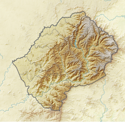
Läge i Lesotho | |
Maseru är ett distrikt i Lesotho.[1] Det ligger i den centrala delen av landet, 40 km sydost om huvudstaden Maseru. Antalet invånare är 316 155.[1] Arean är 4 279 kvadratkilometer. Maseru gränsar till Berea, Thaba-Tseka, Mohale's Hoek District, Mafeteng District och Fristatsprovinsen.
Terrängen i Maseru är kuperad åt nordväst, men åt sydost är den bergig.[a]
Maseru delas in i:
- Semonkong Community
- Qiloane Community
- Lilala Community
- Makheka Community
- Makhoarane Community
- Makhalaneng Community
- Makhaleng Constituency
- Makolopetsane Community
- Manonyane Community
- Abia Community
- Lithabaneng Community
- Lithoteng Community
- Motimposo Community
- Qoaling Community
- Stadium Area Community
- Maseru Central Community
- Mazenod Community
- Mohlakeng Community
- Nyakosoba Community
- Ratau Community
- Telle Community
- Tajane Community
- Rothe
Följande samhällen finns i Maseru:
- Maseru
- Nako
Kommentarer
Källor
- ^ [a b c] Maseru hos Geonames.org (cc-by); post uppdaterad 2013-02-07; databasdump nerladdad 2016-10-20
- ^ ”Viewfinder Panoramas Digital elevation Model”. http://www.viewfinderpanoramas.org/dem3.html. Läst 21 juni 2015.
Media som används på denna webbplats
Robot icon
Författare/Upphovsman:
- File:Lesotho location map.svg by Spischot
- derivative work by Htonl
Relief location map of Lesotho
Equirectangular projection. Geographic limits of the map:
- N: 28.33° S
- S: 30.89° S
- W: 26.74° E
- E: 29.62° E
Shiny red button/marker widget. Used to mark the location of something such as a tourist attraction.


