Maryland County
| Maryland County | ||
| Maryland | ||
| Region | ||
| ||
| Land | ||
|---|---|---|
| Höjdläge | 94 m ö.h. | |
| Koordinater | 4°45′N 7°45′V / 4.75°N 7.75°V | |
| Huvudort | Harper | |
| Area | 2 297,00 km² | |
| Folkmängd | 136 404 | |
| Befolkningstäthet | 59 invånare/km² | |
| Tidszon | UTC (UTC+0) | |
| ISO 3166-2-kod | LR-MY | |
| Geonames | 2275099 | |
Läge i Liberia | ||
Maryland County är en region i Liberia.[1] Den ligger i den sydöstra delen av landet, 400 km sydost om huvudstaden Monrovia. Antalet invånare är 136 404. Arean är 2 297 kvadratkilometer. Dess regionhuvudort är Harper.
Maryland County delas in i två distrikt: Barrobo District och Pleebo/Sodeken District.[2]
Källor
- ^ Maryland County hos Geonames.org (cc-by); post uppdaterad 2012-01-16; databasdump nerladdad 2015-05-23
- ^ ”Maryland County” (på engelska). TODAY LIB. https://todayliberia.weebly.com/maryland-county.html. Läst 23 november 2024.
Externa länkar
 Wikimedia Commons har media som rör Maryland County.
Media som används på denna webbplats
Shiny red button/marker widget. Used to mark the location of something such as a tourist attraction.
Författare/Upphovsman: Uwe Dedering, Licens: CC BY-SA 3.0
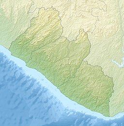
Relief location map of Liberia.
- Projection: Equirectangular projection, strechted by 101.0%.
- Geographic limits of the map:
- N: 8.8° N
- S: 4.0° N
- W: -11.8° E
- E: -7.0° E
- GMT projection: -JX16.933333333333334cd/17.102666666666668cd
- GMT region: -R-11.8/4.0/-7.0/8.8r
- GMT region for grdcut: -R-11.8/4.0/-7.0/8.8r
- Relief: SRTM30plus.
- Made with Natural Earth. Free vector and raster map data @ naturalearthdata.com.
Författare/Upphovsman: The original uploader was Acntx på engelska Wikipedia., Licens: CC BY-SA 3.0
Map of Liberia showing Maryland County; created with the GIMP. Made by en:User:Acntx.
Författare/Upphovsman: Fry1989, Licens: CC BY-SA 3.0
Flag of the Liberian County of Maryland.


