Marion (olika betydelser)
Marion kan syfta på:
- Marion – en figur i Robin Hood-myten
- Marion (fiskefartyg) – ett tidigare svenskt fiskefartyg
- Marion (musikgrupp) – en brittisk musikgrupp
- Marion (namn) – ett flicknamn, även ett pojknamn
- Marion Power Shovel Company – amerikansk tillverkare av grävmaskiner
- Marion 7400 – en släpgrävmaskin
Personer
- Marion Bartoli
- Marion Butler
- Marion Cotillard
- Marion Dönhoff
- Marion Harris (1896–1944) amerikansk sångerska
- Marion Jones
- Marion King Hubbert
- Marion Ogilvy
- Marion Michael Morrison
- Marion Ravn
- Marion Gordon Robertson
- Marion Rung
- Marion V. Williams
- Marion Yorck von Wartenburg
- Marion Zimmer Bradley
Geografi
Australien
- Marion (ort i Australien, South Australia, Marion), 35°01′00″S 138°34′00″Ö / 35.01667°S 138.56667°Ö
- Marion (region), South Australia, 35°00′48″S 138°33′12″Ö / 35.01322°S 138.55339°Ö
Sydafrika
- Marion Island – ö i ögruppen Prins Edwardöarna
USA
- Marion, Alabama, countyhuvudort, Perry County, 32°37′56″N 87°19′09″V / 32.63235°N 87.31917°V
- Marion, Arkansas, countyhuvudort, Crittenden County, 35°12′52″N 90°11′47″V / 35.21453°N 90.19648°V
- Marion, Illinois, countyhuvudort, Williamson County, 37°43′50″N 88°55′59″V / 37.73061°N 88.93313°V
- Marion, Kansas, countyhuvudort, Marion County, 38°20′54″N 97°01′02″V / 38.34835°N 97.01725°V
- Marion, Kentucky, countyhuvudort, Crittenden County, 37°19′58″N 88°04′52″V / 37.33283°N 88.08113°V
- Marion, Louisiana, ort, Union Parish, 32°54′05″N 92°14′31″V / 32.90152°N 92.24208°V
- Marion, Mississippi, ort, Lauderdale County, 32°25′02″N 88°38′52″V / 32.41736°N 88.64782°V
- Marion, North Carolina, countyhuvudort, McDowell County, 35°41′02″N 82°00′33″V / 35.68401°N 82.00927°V
- Marion, Pennsylvania, ort, Franklin County, 39°51′26″N 77°41′43″V / 39.85731°N 77.69527°V
- Marion, South Carolina, countyhuvudort, Marion County, 34°10′42″N 79°24′02″V / 34.17822°N 79.40061°V
- Marion, Texas, ort, Guadalupe County, 29°34′17″N 98°08′25″V / 29.57134°N 98.14029°V
- Marion, Virginia, countyhuvudort, Smyth County, 36°50′05″N 81°30′53″V / 36.83484°N 81.51484°V
- Marion, Iowa, ort, Linn County, 42°02′03″N 91°35′52″V / 42.03417°N 91.59768°V
- Marion, Indiana, countyhuvudort, Grant County, 40°33′30″N 85°39′33″V / 40.55837°N 85.65914°V
- Marion, Massachusetts, ort, Plymouth County, 41°42′00″N 70°45′46″V / 41.7001°N 70.76281°V
- Marion, Michigan, Osceola County, 44°06′09″N 85°08′49″V / 44.10251°N 85.14698°V
- Marion, North Dakota, ort, LaMoure County, 46°36′26″N 98°19′56″V / 46.6072°N 98.33232°V
- Marion, New York, ort, Wayne County, 43°08′36″N 77°11′21″V / 43.1434°N 77.18915°V
- Marion, Ohio, countyhuvudort, Marion County, 40°35′19″N 83°07′43″V / 40.58867°N 83.12852°V
- Marion, South Dakota, ort, Turner County, 43°25′23″N 97°15′38″V / 43.42304°N 97.26062°V
- Marion, Wisconsin, ort, Waupaca County, 44°40′15″N 88°53′21″V / 44.67081°N 88.88927°V
- Marion, Montana, ort, Flathead County, 48°06′20″N 114°39′47″V / 48.10551°N 114.66319°V
- Marion, Oregon, ort, Marion County, 44°44′56″N 122°56′32″V / 44.74901°N 122.94231°V
- Marion, Utah, ort, Summit County, 40°40′39″N 111°16′52″V / 40.67745°N 111.28102°V
Se även
- Marion County
Media som används på denna webbplats
Shiny blue button/marker widget.
Författare/Upphovsman: TUBS
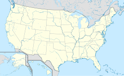
Location map of the USA (Hawaii and Alaska shown in sidemaps).
Main map: EquiDistantConicProjection : Central parallel :
* N: 37.0° N
Central meridian :
* E: 96.0° W
Standard parallels:
* 1: 32.0° N
* 2: 42.0° N
Made with Natural Earth. Free vector and raster map data @ naturalearthdata.com.
Formulas for x and y:
x = 50.0 + 124.03149777329222 * ((1.9694462586094064-({{{2}}}* pi / 180))
      * sin(0.6010514667026994 * ({{{3}}} + 96) * pi / 180))
y = 50.0 + 1.6155950752393982 * 124.03149777329222 * 0.02613325650382181
      - 1.6155950752393982  * 124.03149777329222 *
     (1.3236744353715044  - (1.9694462586094064-({{{2}}}* pi / 180))
      * cos(0.6010514667026994 * ({{{3}}} + 96) * pi / 180))
Hawaii side map: Equirectangular projection, N/S stretching 107 %. Geographic limits of the map:
- N: 22.4° N
- S: 18.7° N
- W: 160.7° W
- E: 154.6° W
Alaska side map: Equirectangular projection, N/S stretching 210.0 %. Geographic limits of the map:
- N: 72.0° N
- S: 51.0° N
- W: 172.0° E
- E: 129.0° W
Logo for disambiguation pages.
Författare/Upphovsman: Tentotwo, Licens: CC BY-SA 3.0
Location map of the Indian Ocean.
- Projection: Lambert azimuthal equal-area projection.
- Area of interest:
- N: 30.0° N
- S: -70.0° N
- W: 30.0° E
- E: 150.0° E
- Projection center:
- NS: -20.0° N
- WE: 90.0° E
- GMT projection: -JA90.0/-20.0/180/19.998266666666666c
- GMT region: -R-12.856058461183775/-43.848273739920856/151.50519408595028/33.22162400070504r
- Land and shoreline: 1:110m Natural Earth Datasets, borders 1:50m
Författare/Upphovsman: NordNordWest, Licens: CC BY-SA 3.0
Location map of Australia


