Mangere Island
| Mangere Island | |
| Mangari, Mangere | |
| Ö | |
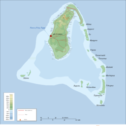
Karta över hela atollen | |
| Land | |
|---|---|
| Koordinater | 18°52′06″S 159°45′03″V / 18.86828°S 159.7507°V |
| Tidszon | HAST (UTC-10) |
| Geonames | 4035666 |
Mangere Island är en ö i Cooköarna (Nya Zeeland).[1] Den ligger i den norra delen av landet, intill ön Aitutaki.
Källor
- ^ Mangere Island at GeoNames.Org (cc-by); post uppdaterad 2014-11-16; databasdump nerladdad 2016-01-30
Media som används på denna webbplats
Shiny red button/marker widget. Used to mark the location of something such as a tourist attraction.
Carte topographique d'Aitutaki/Topographic map of Aitutaki
Författare/Upphovsman: NordNordWest, Licens: CC BY 3.0
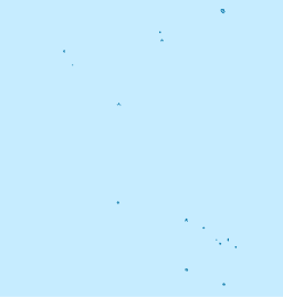
Location map of the Cook Islands


