Main Range nationalpark
| Main Range National Park | |
| Nationalpark | |
Mount Mitchell (1168 m ö.h.). | |
| Land | |
|---|---|
| Delstat | Queensland |
| Höjdläge | 651 m ö.h. |
| Koordinater | 28°05′57″S 152°25′05″Ö / 28.09917°S 152.41806°Ö |
| Tidszon | AEST (UTC+10) |
| Geonames | 8157784 8157898 |
Main Range nationalpark är en nationalpark i Australien.[1] Den ligger i delstaten Queensland, i den östra delen av landet, 900 km norr om huvudstaden Canberra.
I omgivningarna runt Main Range nationalpark växer i huvudsak städsegrön lövskog.[2]
Kommentarer
Källor
- ^ Main Range National Park hos GeoNames.Org (cc-by); post uppdaterad 2012-01-22; databasdump nerladdad 2015-12-01
- ^ ”NASA Earth Observations: Land Cover Classification”. NASA/MODIS. Arkiverad från originalet den 28 februari 2016. https://web.archive.org/web/20160228161657/http://neo.sci.gsfc.nasa.gov/view.php?datasetId=MCD12C1_T1. Läst 30 januari 2016.
Media som används på denna webbplats
Författare/Upphovsman: , Licens: CC BY-SA 3.0
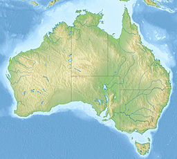
Relief map of Australia, including the borders of the states of the Commonwealth of Australia
Shiny red button/marker widget. Used to mark the location of something such as a tourist attraction.
View westwards of Mount Mitchell.


