Mahdia, Guyana
| Mahdia | |
| Stad | |
Huvudgatan genom Mahdia | |
| Land | |
|---|---|
| Region | Potaro-Siparuni |
| Höjdläge | 415 m ö.h. |
| Koordinater | 5°16′55″N 59°8′58″V / 5.28194°N 59.14944°V |
| Folkmängd | 2 563 (2012)[1] |
| Tidszon | AST (UTC-4) |
| Geonames | 3377263 |
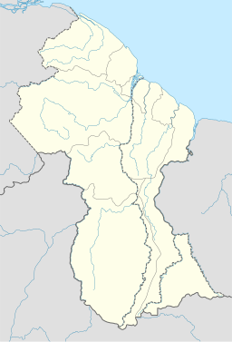
Läge i Guyana | |
Mahdia är en stad i regionen Potaro-Siparuni i centrala Guyana. Staden hade 2 563 invånare vid folkräkningen 2012.[1] Den är huvudort i regionen Potaro-Siparuni och ligger cirka 202 kilometer sydväst om Georgetown.
Referenser
- ^ [a b] ”Population by Village 2012” (på engelska) (ZIP). Statistics Guyana. https://statisticsguyana.gov.gy/wp-content/uploads/2019/10/Population_by_Village_2012.zip. Läst 11 januari 2022.
Externa länkar
 Wikimedia Commons har media som rör Mahdia.
Media som används på denna webbplats
Shiny red button/marker widget. Used to mark the location of something such as a tourist attraction.
Författare/Upphovsman: NordNordWest, Licens: CC BY-SA 3.0
Location map of Guyana
Part of the commercial area of Mahdia, Guyana, along the main road through the community; Commercial_area_in Mahdia.jpg


