Mahalapye
| Mahalapye | |
| village | |
Traditionella hus i Mahalapye | |
| Land | |
|---|---|
| Distrikt | Central |
| Koordinater | 23°6′S 26°50′Ö / 23.100°S 26.833°Ö |
| Folkmängd | 43 298 (2011)[1] |
| Tidszon | CAT (UTC+2) |
| Geonames | 933471 |
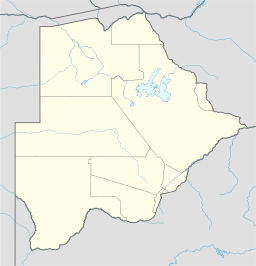
Mahalapyes läge i Botswana | |
Mahalapye är en stad i östra Botswana, belägen i distriktet Central.
Källor
- ^ ”2011 Botswana Population and Housing Census” (
 PDF). Statistics Botswana. http://www.statsbots.org.bw/sites/default/files/2011%20Population%20and%20Housing%20Census%20%28Results%29.pdf. Läst 4 november 2017.
| |||||||||||||
Media som används på denna webbplats
Shiny red button/marker widget. Used to mark the location of something such as a tourist attraction.
Författare/Upphovsman: NordNordWest, Licens: CC BY-SA 3.0
Location map of Botswana
Tradition house in Mahalapye, Botswana. Author: Tomas Petersson. 2004.


