Magellans sund
| Magellans sund (Estrecho de Magallanes) | |
| Magalhães sund | |
| Sund | |
Satellitbild över Magellans sund | |
| Land | |
|---|---|
| Koordinater | 54°00′S 71°00′V / 54.0°S 71.0°V |
| Geonames | 3845265 |
Magellans sund eller Magalhães sund är ett sund som skiljer Eldslandet från fastlandet i Sydamerika. Båda sidorna av det 550[1] km långa sundet tillhör Chile. Det har fått sitt namn av upptäcktsresanden Ferdinand Magellan.
Sundet är en av de viktigaste naturliga passagerna mellan Stilla havet och Atlanten. Det anses dock vara svårt att navigera igenom, på grund av det ogästvänliga och regniga klimatet och att passagen är relativt trång. Vid sundet ligger även Kap Froward som är det sydamerikanska fastlandets sydligaste plats.
Fram till att Panamakanalen blev klar år 1914 var Magellans sund ofta det enda säkra sättet att ta sig mellan Atlanten och Stilla havet, då fartyg skyddades av Eldslandet i syd och Sydamerika i norr. Passagen var säkrare än Drakes sund, som är en relativt trång bit hav mellan Kap Horn och Antarktis. Vattnen där är extremt turbulenta och oförutsägbara, och isberg förekommer ofta. Fram till att Panamakanalen byggdes var Magellans sund den vanligaste passagen mellan Atlanten och Stilla havet för ångfartyg, medan Drakes sund var den vanligaste passagen för segelfartyg som har svårt för trånga passager.
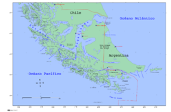
Sundets östra inlopp ligger i den breda bukten vid gränsen mellan Chile och Argentina. I väster finns flera olika inlopp.
Ferdinand Magellan var den första att segla igenom sundet år 1520, under den första världsomseglingen. Då Magellan passerade sundet den 1 november kallades det ursprungligen "Estreito de Todos os Santos" (Alla helgons sund).
Den 23 maj 1843 tog Chile sundet i beslag. Vid kusten längs med sundet ligger staden Punta Arenas och orten Porvenir.
Passagen korsades av många tidiga utforskare, förutom Magellan bland andra även Francis Drake och Charles Darwin.
Referenser
- ^ ”Magellans sund”. ne.se. https://www.ne.se/uppslagsverk/encyklopedi/l%C3%A5ng/magellans-sund. Läst 20 september 2018.
Externa länkar
 Wikimedia Commons har media som rör Magellans sund.
Media som används på denna webbplats
Det är enkelt att lägga till en ram runt den här bilden
Författare/Upphovsman:
- Chile_location_map.svg: NordNordWest
- derivative work: Виктор В (talk)
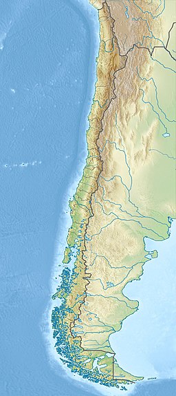
Location map of Chile
Shiny red button/marker widget. Used to mark the location of something such as a tourist attraction.
Författare/Upphovsman: Createaccount, Licens: CC BY-SA 3.0
Strait of Magellan, Chile
Straits of Magellan (June 21, 2004) - The Nimitz-class aircraft carrier USS Ronald Reagan (CVN 76) cruises through the Straits of Magellan on her way to the Pacific Ocean. Reagan is underway circumnavigating South America in transit to her new homeport of San Diego, Calif., while participating in exercises supporting Summer Pulse 2004. Summer Pulse 2004 is the simultaneous deployment of seven aircraft strike groups (CSGs), demonstrating the ability of the Navy to provide credible combat across the globe, in five theaters with other U.S., allied, and coalition military forces. Summer Pulse is the Navy’s first deployment under its new Fleet Response Plan (FRP). U.S. Navy photo by Photographer's Mate 3rd Class Elizabeth Thompson (RELEASED)For more information go to: <a href="http://www.cffc.navy.mil/summerpulse04.htm" Target="_BLANK">www.cffc.navy.mil/summerpulse04.htm</a>
Författare/Upphovsman: Miguel Vieira, Licens: CC BY 2.0
Commerson's dolphins (Cephalorhynchus commersonii) in the Strait of Magellan
Until the Panama Canal was finished in 1914, the Strait of Magellan was the only safe way to move between the Atlantic and Pacific Oceans. Protected by the Tierra del Fuego to the south and the bulk of South America to the north, ships crossed in relative ease, removed from the dangers of Drake Passage. Drake Passage is the relatively narrow stretch of ocean separating South America from Antarctica, the waters of which are notoriously turbulent, unpredictable, and frequented by icebergs and sea ice. In this unusually clear true-color Moderate Resolution Imaging Spectroradiometer (MODIS) image, the entire Strait is visible. The eastern opening is the wide bay on the border of Chile and Argentina. To the west, there are a number of access points from the Pacific, though the most easily seen here is the roughly 200 km stretch from the Queen Adelaide Archipelago (at center left) to the bulk of the Strait (at lower center). The islands and mountains are highlighted by bright white snow, while the lower-elevation lands to the north and east remain clear. This image was acquired by the Aqua satellite on August 27, 2003.
Författare/Upphovsman: Magallanes1, Licens: CC0
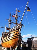
Replica de la Nao Victoria de Hernando de Magallanes en la ciudad de Punta Arenas


