Magallanes (provins)
| Den här artikeln har skapats av Lsjbot, ett program (en robot) för automatisk redigering. (2016-02) Artikeln kan innehålla fakta- eller språkfel, eller ett märkligt urval av fakta, källor eller bilder. Mallen kan avlägsnas efter en kontroll av innehållet (vidare information) |
| Provincia de Magallanes | |
| Provins | |
| Land | |
|---|---|
| Region | Región de Magallanes y de la Antártica Chilena |
| Höjdläge | 44 m ö.h. |
| Koordinater | 52°55′00″S 71°05′00″V / 52.91667°S 71.08333°V |
| Area | 36 400,80 km² |
| Folkmängd | 129 199från enwiki |
| Befolkningstäthet | 4 invånare/km² |
| Tidszon | BRT (UTC-3) |
| - sommartid | EDT (UTC-4) |
| Geonames | 3881037 |
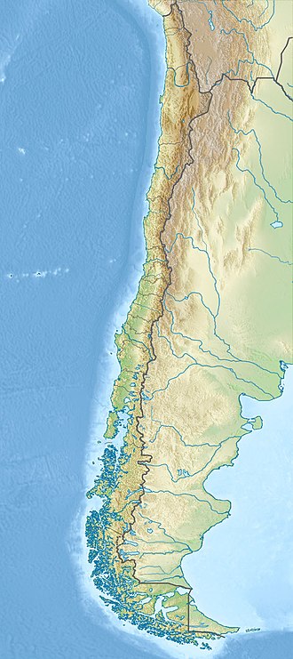
Provincia de Magallanes är en provins i Chile.[1] Den ligger i regionen Región de Magallanes y de la Antártica Chilena, i den södra delen av landet, 2 200 km söder om huvudstaden Santiago de Chile. Antalet invånare är 129 199.[2] Arean är 36 401 kvadratkilometer.
Terrängen i Provincia de Magallanes är huvudsakligen kuperad, men västerut är den bergig.[a]
Provincia de Magallanes delas in i:
Trakten runt Provincia de Magallanes består i huvudsak av gräsmarker.[4] Trakten runt Provincia de Magallanes är nära nog obefolkad, med mindre än två invånare per kvadratkilometer.[5]
Kommentarer
Källor
- ^ Provincia de Magallanes hos GeoNames.Org (cc-by); post uppdaterad 2012-05-06; databasdump nerladdad 2016-01-31
- ^ (uppgift tagen från enwiki 2015-07-14)
- ^ ”Viewfinder Panoramas Digital elevation Model”. http://www.viewfinderpanoramas.org/dem3.html. Läst 21 juni 2015.
- ^ ”NASA Earth Observations: Land Cover Classification”. NASA/MODIS. Arkiverad från originalet den 28 februari 2016. https://web.archive.org/web/20160228161657/http://neo.sci.gsfc.nasa.gov/view.php?datasetId=MCD12C1_T1. Läst 30 januari 2016.
- ^ ”NASA Earth Observations: Population Density”. NASA/SEDAC. Arkiverad från originalet den 9 februari 2016. https://web.archive.org/web/20160209064446/http://neo.sci.gsfc.nasa.gov/view.php?datasetId=SEDAC_POP. Läst 30 januari 2016.
Media som används på denna webbplats
Robot icon
Det är enkelt att lägga till en ram runt den här bilden
Shiny red button/marker widget. Used to mark the location of something such as a tourist attraction.
Until the Panama Canal was finished in 1914, the Strait of Magellan was the only safe way to move between the Atlantic and Pacific Oceans. Protected by the Tierra del Fuego to the south and the bulk of South America to the north, ships crossed in relative ease, removed from the dangers of Drake Passage. Drake Passage is the relatively narrow stretch of ocean separating South America from Antarctica, the waters of which are notoriously turbulent, unpredictable, and frequented by icebergs and sea ice. In this unusually clear true-color Moderate Resolution Imaging Spectroradiometer (MODIS) image, the entire Strait is visible. The eastern opening is the wide bay on the border of Chile and Argentina. To the west, there are a number of access points from the Pacific, though the most easily seen here is the roughly 200 km stretch from the Queen Adelaide Archipelago (at center left) to the bulk of the Strait (at lower center). The islands and mountains are highlighted by bright white snow, while the lower-elevation lands to the north and east remain clear. This image was acquired by the Aqua satellite on August 27, 2003.
Författare/Upphovsman:
- Chile_location_map.svg: NordNordWest
- derivative work: Виктор В (talk)
Location map of Chile


