Mělník
| Mělník | |||
| Stad | |||
| |||
| Land | |||
|---|---|---|---|
| Region | Mellersta Böhmen | ||
| Distrikt | Mělník | ||
| Höjdläge | 215 m ö.h. | ||
| Koordinater | 50°21′2″N 14°28′27″Ö / 50.35056°N 14.47417°Ö | ||
| Area | 24,97 km² | ||
| Folkmängd | 19 230 (1 januari 2016)[1] | ||
| Befolkningstäthet | 770 invånare/km² | ||
| Tidszon | CET (UTC+1) | ||
| - sommartid | CEST (UTC+2) | ||
| Postnummer | 276 01 | ||
| Geonames | 3070862 | ||
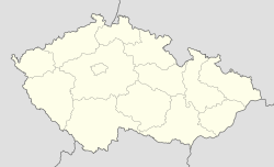
Läge i Tjeckien | |||
Mělník är en stad i Mellersta Böhmen i Tjeckien. Staden ligger cirka 35 kilometer norr om Prag och är belägen där floderna Elbe och Moldau möts. Befolkningen uppgår till cirka 19 230 (2016).[1] Mělníks slott är uppfört i renässansstil och tillhör stadens sevärdheter. I det kringliggande området produceras bland annat frukt, grönsaker och vin.
- Mělníks slott.
Referenser
Externa länkar
 Wikimedia Commons har media som rör Mělník.
Media som används på denna webbplats
Shiny red button/marker widget. Used to mark the location of something such as a tourist attraction.
Znak města Mělník
Författare/Upphovsman: Lencer, Licens: CC BY-SA 3.0
Location map of the Czech Republic
Författare/Upphovsman: Hans Weingartz=Leonce49, Licens: CC BY-SA 2.0 de
NE side of the Peace Square in Mělník, the centre of the town. In the backgrund the historical town hall.
Författare/Upphovsman: Mgr. Renata Špačková, Licens: CC BY-SA 3.0 cz
Mělnický zámek s kostelní věží.


