Lyndonville, New York
| Lyndonville | |
| Village of Lyndonville | |
| village | |
Lyndonville i Orleans County, New York | |
| Land | |
|---|---|
| Delstat | New York |
| County | Orleans County |
| Koordinater | 43°19′26″N 78°23′16″V / 43.32389°N 78.38778°V |
| Yta | 2,7 km² |
| - land | 2,7 km² |
| - vatten | 0 km² |
| Folkmängd | 797 (2016)[1] |
| Befolkningstäthet | 295 invånare/km² |
| Grundad | 1903 |
| Borgmästare | John Belson |
| Tidszon | EST (UTC-5) |
| - sommartid | EDT (UTC-4) |
| Riktnummer | 585 |
| Geonames | 5125534 |
(c) NordNordWest, CC BY 3.0 Ortens läge i delstaten New York | |
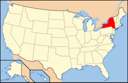
New Yorks läge i USA | |
| Webbplats: http://www.villageoflyndonville.com/ | |
Lyndonville är en administrativ enhet, en village, i nordvästra delen av Orleans County, New York.
De första bosättarna kom till Lyndonville för att kunna utnyttja vattenkraften i Johnsons Creek. 1903 grundades Village of Lyndonville, en egen administrativ enhet skild från Yates som omger samhället. Orten har fått sitt namn efter att flera av de tidigaste nybyggarna kom från Lyndon, Vermont.[2]
Politik
Lyndonville har en vald styrelse och en borgmästare (mayor).[3]
Källor
- ^ American Fact Finder, United States Census Bureau, läst 28 november 2017.
- ^ Village History Arkiverad 6 april 2018 hämtat från the Wayback Machine., Village of Lyndonville, läst 30 november 2017.
- ^ Contact us Arkiverad 1 december 2017 hämtat från the Wayback Machine., Village of Lyndonville, läst 30 november 2017.
| ||||||||||||||
Media som används på denna webbplats
Shiny red button/marker widget. Used to mark the location of something such as a tourist attraction.
Författare/Upphovsman: Rcsprinter123, Licens: CC BY 3.0
Map showing the location of this village within Orleans County, New York.
This is a locator map showing Orleans County in New York. For more information, see Commons:United States county locator maps.
Författare/Upphovsman: Huebi, Licens: CC BY 2.0
Map of USA with New York highlighted
(c) NordNordWest, CC BY 3.0
Location map of the State of New York, USA


