Ludlow (olika betydelser)
Ludlow kan syfta på följande:
- Ludlow (geologisk tidsperiod) – en geologisk tidsperiod
- Ludlow (typografiskt system) – ett typografiskt system
- Ludlowmassakern - en massaker i USA, 1914
Geografi
Australien
- Ludlow (ort i Australien), Western Australia, Busselton, 33°36′00″S 115°28′00″Ö / 33.6°S 115.46667°Ö
Storbritannien
- Ludlow, stad i Shropshire, England, 52°22′28″N 2°42′47″V / 52.37431°N 2.71311°V
- Ludlow Castle, en borgruin i Ludlow
- Ludlow College, ett college i Ludlow
USA
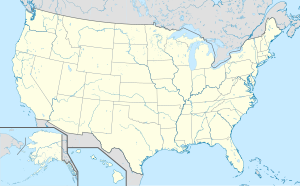
- Ludlow, Kentucky, Kenton County, 39°05′33″N 84°32′51″V / 39.09256°N 84.54744°V
- Ludlow, Missouri, Livingston County, 39°39′18″N 93°42′08″V / 39.65502°N 93.70216°V
- Ludlow, Illinois, Champaign County, 40°23′13″N 88°07′39″V / 40.38698°N 88.12754°V
- Ludlow, Massachusetts, Hampden County, 42°09′36″N 72°28′33″V / 42.16009°N 72.47592°V
- Ludlow, Maine, Aroostook County, 46°08′26″N 68°02′24″V / 46.14061°N 68.04002°V
- Ludlow, Vermont, kommun i Windsor County, 43°23′45″N 72°42′02″V / 43.39591°N 72.70065°V
- Ludlow (bykommun i Vermont), bykommun i Windsor County, 43°23′45″N 72°42′02″V / 43.39591°N 72.70065°V
- Ludlow, Colorado, spökstad i Colorado, 37°20′00″N 104°35′00″V / 37.333333°N 104.583333°V
Personer
- Edmund Ludlow, engelsk politiker
- George C. Ludlow, guvernör i New Jersey, 1881-1884
- Peter Ludlow, amerikansk filosof
| Det här är en förgreningssida som listar artiklar associerade med titeln Ludlow. Om du kom hit via en wikilänk, får du gärna ändra länken så att den hänvisar direkt till den avsedda sidan. |
Media som används på denna webbplats
Författare/Upphovsman: NordNordWest, Licens: CC BY-SA 3.0
Location map of Australia
Shiny blue button/marker widget.
Författare/Upphovsman: TUBS
Location map of the USA (Hawaii and Alaska shown in sidemaps).
Main map: EquiDistantConicProjection : Central parallel :
* N: 37.0° N
Central meridian :
* E: 96.0° W
Standard parallels:
* 1: 32.0° N
* 2: 42.0° N
Made with Natural Earth. Free vector and raster map data @ naturalearthdata.com.
Formulas for x and y:
x = 50.0 + 124.03149777329222 * ((1.9694462586094064-({{{2}}}* pi / 180))
      * sin(0.6010514667026994 * ({{{3}}} + 96) * pi / 180))
y = 50.0 + 1.6155950752393982 * 124.03149777329222 * 0.02613325650382181
      - 1.6155950752393982  * 124.03149777329222 *
     (1.3236744353715044  - (1.9694462586094064-({{{2}}}* pi / 180))
      * cos(0.6010514667026994 * ({{{3}}} + 96) * pi / 180))
Hawaii side map: Equirectangular projection, N/S stretching 107 %. Geographic limits of the map:
- N: 22.4° N
- S: 18.7° N
- W: 160.7° W
- E: 154.6° W
Alaska side map: Equirectangular projection, N/S stretching 210.0 %. Geographic limits of the map:
- N: 72.0° N
- S: 51.0° N
- W: 172.0° E
- E: 129.0° W
(c) Baumst, CC BY-SA 3.0
Disambiguation icon – gray scale version (author: Stephan Baum).
(c) Karte: NordNordWest, Lizenz: Creative Commons by-sa-3.0 de
Location map of Northern Ireland, United Kingdom


