Llanishen
| Llanishen (Llanisien) | |
| Community | |
(c) Steve Chapple, CC BY-SA 2.0 | |
| Land | |
|---|---|
| Riksdel | Wales |
| Kommun | Cardiff |
| Koordinater | 51°31′44″N 3°11′22″V / 51.5290°N 3.1894°V |
| Area | 4,81 km²[a] |
| Folkmängd | 17 417 (2011)[1][a] |
| Befolkningstäthet | 3 621 invånare/km² |
| Tidszon | UTC (UTC+0) |
| - sommartid | BST (UTC+1) |
| Geonames | 7292889 2643986 |
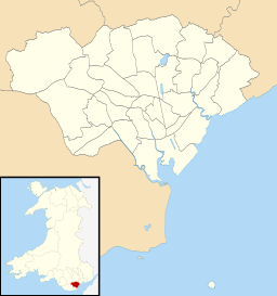
Contains Ordnance Survey data © Crown copyright and database right, CC BY-SA 3.0 Läge i Cardiff | |
Läge i Storbritannien | |
Llanishen är en community i Storbritannien.[1] Den ligger i kommunen Cardiff och riksdelen Wales, i den södra delen av landet, 210 km väster om huvudstaden London. Llanishen är en förort i norra delen av Cardiff.
Tidigare ingick området Thornhill i Llanishen community, men den 1 december 2016 bröts Thornhill ut och bildade en egen community.[2]
Noter
Källor
- ^ [a b] ”Llanishen Parish”. Office for National Statistics. https://www.nomisweb.co.uk/reports/localarea?compare=W04000852. Läst 8 juli 2022.
- ^ ”The City and County of Cardiff (Communities) Order 2016 No.1155”. The City and County of Cardiff. Arkiverad från originalet den 21 oktober 2020. https://web.archive.org/web/20201021221641/https://www.cardiff.gov.uk/ENG/Your-Council/Voting-and-elections/Community-review/Documents/statutory_instruments_jan17/Welsh%20Statutory%20Instruments%202016%20combined.pdf. Läst 8 juli 2022.
Media som används på denna webbplats
Shiny red button/marker widget. Used to mark the location of something such as a tourist attraction.
Författare/Upphovsman: Alexrk2, Licens: CC BY-SA 3.0
Location map of the United Kingdom
(c) Steve Chapple, CC BY-SA 2.0
Government offices, Llanishen, Cardiff Government tax office at Parc-Ty-Glas, Cardiff.
Contains Ordnance Survey data © Crown copyright and database right, CC BY-SA 3.0
Blank map of Cardiff, UK with communities shown.
Equirectangular map projection on WGS 84 datum, with N/S stretched 160%
Geographic limits:
- West: 3.35W
- East: 3.05W
- North: 51.57N
- South: 51.37N


