Livingstonefallen
| Livingstonefallen (Chutes de Livingstone) | |
| Cataractes Livingstone | |
| Vattenfall | |
| Länder | |
|---|---|
| Departement/Provins | Brazzaville, Pool, Kinshasa, Kongo-Central |
| Koordinater | 4°50′00″S 14°30′00″Ö / 4.83333°S 14.5°Ö |
| Tidszon | WAT (UTC+1) |
| Geonames | 2258389 |
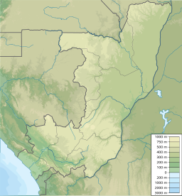
Livingstonefallen (franska: Chutes de Livingstone eller Chutes Livingstone) är en serie vattenfall och forsar i Kongofloden mellan Kongo-Brazzaville och Kongo-Kinshasa. Fallen sträcker sig mellan Malebodammen – mellan huvudstäderna Brazzaville och Kinshasa – och Matadi. Det övre loppet utgör gräns mellan städerna och mellan departementet Pool i Kongo-Brazzaville och provinsen Kongo-Central i Kongo-Kinshasa, medan det nedre loppet korsar Kongo-Central. Henry Morton Stanley gav fallen namnet Livingstone Falls efter David Livingstone.[1][2]
Källor
- ^ Droogmans, Hubert (1901) (på franska). Notices sur le Bas-Congo. Bryssel: Imprimerie Vanbuggenhoudt. sid. 260–263. https://archive.org/details/noticessurlebasc00droo/
- ^ The Geographer (1972). ”Republic of the Congo (Congo) – Democratic Republic of the Congo (Zaire) Boundary” (på engelska). International Boundary Study (Washington DC: Office of the Geographer, Bureau of Intelligence and Research) 127: sid. 7. http://library.law.fsu.edu/Digital-Collections/LimitsinSeas/pdf/ibs127.pdf. Läst 3 januari 2022.
Media som används på denna webbplats
Shiny red button/marker widget. Used to mark the location of something such as a tourist attraction.
Författare/Upphovsman: Internet Archive Book Images, Licens: No restrictions
Identifier: throughdarkconti00henr (find matches)
Title: Through the dark continent : or, The sources of the Nile around the great lakes of equatorial Africa and down the Livingstone River to the Atlantic Ocean
Year: 1899 (1890s)
Authors: Henry M. Stanley
Subjects:
Publisher: George Newnes
Contributing Library: Gumberg Library, Duquesne University
Digitizing Sponsor: Lyrasis Members and Sloan Foundation
View Book Page: Book Viewer
About This Book: Catalog Entry
View All Images: All Images From Book
Click here to view book online to see this illustration in context in a browseable online version of this book.
Text Appearing Before Image:
n fish and cassava. A goat was not to beobtained at any price, and for a chicken they demanded agun ! Cassava, however, was abundant. From the confluence we formed another brush-coveredroad, and hauled the canoes over another 800 yards into acreek, which enabled us to reach, on the 20th, a wide sand-bar that blocked its passage into the great river. The sand-bar, in its turn, enabled us to reach the now moderatedstream, below the influence of the roaring Father, and toproceed by towing and punting half a mile below to an inletin the rocky shore. Gampa, the young chief of this district, became veryfriendly, and visited us each day with small gifts of cassavabread, a few bananas, and a small gourd of palm-wine. Mar. 21.—On the 21st and the two days following wewere engaged in hauling our vessels overland, a distance otthree-cparters of a mile, over a broad rocky point, into abay-like formation. Gampa and his people nerved us toprosecute our labours by declaring that there was only one
Text Appearing After Image:
1877.) IN THE CAULDRON. 263 small cataract below. Full of hope, we lialtc<l on the 24thto rest the wearietl people, and in the meantime to trade forfood. Mar. 25.—The 25tli saw us at work at dawn in a badpiece of river, which is siguificautly styled the Cauldron.Our best canoe, 75 feet long, 3 feet wide, by 21 inches deep,the famous London Toim, commanded by Manwa Sera, wastorn from the hands of tifty men, and swept away in theearly morning down to destruction. In the afternoon, theGlasgow, parting her cables, was swept away, drawn nearlyinto mid-river, returned up river half a mile, again drawninto the depths, ejected into a bay near where Frank was
Note About Images
Författare/Upphovsman: Urutseg, Licens: CC0
Map of the Republic of the Congo, parameters equivalent to File:Congo location map.svg


