Livingston
Livingston eller Lívingston kan syfta på:
- Livingston University – tidigare namn (1967-95) på University of West Alabama
- Livingston Energy Flight – ett italienskt flygbolag 2003–2010
- Livingston Compagnia Aerea – ett italienskt flygbolag 2011–
- Livingston FC – en skotsk fotbollsklubb
Personer
- Livingston (efternamn) – ett efternamn och personer med namnet
- Robert Livingston Beeckman (1866–1935), amerikansk politiker och guvernör
- Coleman Livingston Blease (1868–1942), amerikansk politiker och guvernör
- Ogden Livingston Mills, Jr (1884–1937), amerikansk politiker
- Livingston Taylor (1950–), amerikansk musiker och kompositör
Geografi
Antarktis
Livingston i Antarktis. |
- Livingston Island – en av Sydshetlandsöarna, Antarktis
Guatemala
Lívingston i Guatemala. |
- Municipio de Lívingston, kommun, 15°49′42″N 88°45′01″V / 15.82826°N 88.75039°V
- Lívingston, kommunhuvudort, Departamento de Izabal, Municipio de Lívingston, 15°49′42″N 88°45′01″V / 15.82826°N 88.75039°V
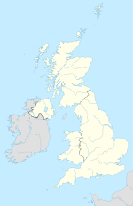
Storbritannien
(c) Karte: NordNordWest, Lizenz: Creative Commons by-sa-3.0 de 1 Livingston i Storbritannien. |
- Livingston, West Lothian – grevskapshuvudort, Skottland, West Lothian, 55°54′10″N 3°31′21″V / 55.90288°N 3.52261°V
USA
Livingston i USA. |
- Livingston, Alabama, countyhuvudort, Sumter County, 32°35′03″N 88°11′14″V / 32.5843°N 88.18725°V
- Livingston, Illinois, ort, Madison County, 38°58′03″N 89°45′50″V / 38.96755°N 89.76398°V
- Livingston, Kentucky, ort, Rockcastle County, 37°17′52″N 84°12′54″V / 37.29786°N 84.21493°V
- Livingston Parish, Louisiana
- Livingston, Louisiana, Livingston Parish, 30°30′08″N 90°44′52″V / 30.50213°N 90.74787°V
- Livingston, South Carolina, ort, Orangeburg County, 33°33′13″N 81°07′07″V / 33.55349°N 81.11871°V
- Livingston, Tennessee, countyhuvudort, Overton County, 36°23′00″N 85°19′23″V / 36.3834°N 85.32302°V
- Livingston, Texas, countyhuvudort, Polk County, 30°42′40″N 94°55′59″V / 30.71103°N 94.93299°V
- Livingston, Wisconsin, ort, Grant County, 42°54′00″N 90°25′51″V / 42.89999°N 90.43096°V
- Livingston, Kalifornien, ort, Merced County, 37°23′13″N 120°43′25″V / 37.38688°N 120.72353°V
- Livingston, Montana, countyhuvudort, Park County, 45°39′45″N 110°33′40″V / 45.66244°N 110.56104°V
- Livingston, New Jersey, 40°47′08″N 74°19′45″V / 40.78565°N 74.32912°V
Se även
Se även
Media som används på denna webbplats
Shiny blue button/marker widget.
(c) Karte: NordNordWest, Lizenz: Creative Commons by-sa-3.0 de
Location map of the United Kingdom
Författare/Upphovsman: TUBS
Location map of the USA (Hawaii and Alaska shown in sidemaps).
Main map: EquiDistantConicProjection : Central parallel :
* N: 37.0° N
Central meridian :
* E: 96.0° W
Standard parallels:
* 1: 32.0° N
* 2: 42.0° N
Made with Natural Earth. Free vector and raster map data @ naturalearthdata.com.
Formulas for x and y:
x = 50.0 + 124.03149777329222 * ((1.9694462586094064-({{{2}}}* pi / 180))
      * sin(0.6010514667026994 * ({{{3}}} + 96) * pi / 180))
y = 50.0 + 1.6155950752393982 * 124.03149777329222 * 0.02613325650382181
      - 1.6155950752393982  * 124.03149777329222 *
     (1.3236744353715044  - (1.9694462586094064-({{{2}}}* pi / 180))
      * cos(0.6010514667026994 * ({{{3}}} + 96) * pi / 180))
Hawaii side map: Equirectangular projection, N/S stretching 107 %. Geographic limits of the map:
- N: 22.4° N
- S: 18.7° N
- W: 160.7° W
- E: 154.6° W
Alaska side map: Equirectangular projection, N/S stretching 210.0 %. Geographic limits of the map:
- N: 72.0° N
- S: 51.0° N
- W: 172.0° E
- E: 129.0° W
Logo for disambiguation pages.
Författare/Upphovsman:
- Guatemala Departments.svg: Daryona
- Mexico location map.svg: NordNordWest
- härlett verk: Spischot
Location map of Guatemala
Författare/Upphovsman: Alexrk2, Licens: CC BY-SA 3.0
Location map Antarctica, Azimuthal equidistant projection


