Lista över vulkaner i Argentina
| Den här artikeln behöver källhänvisningar för att kunna verifieras. (2019-06) Åtgärda genom att lägga till pålitliga källor (gärna som fotnoter). Uppgifter utan källhänvisning kan ifrågasättas och tas bort utan att det behöver diskuteras på diskussionssidan. |
Detta är en lista över vulkaner i Argentina.
Media som används på denna webbplats
Författare/Upphovsman: Tkgd2007, Licens: CC BY-SA 3.0
A new incarnation of Image:Question_book-3.svg, which was uploaded by user AzaToth. This file is available on the English version of Wikipedia under the filename en:Image:Question book-new.svg
The volcanic complex in the center of this NASA Landsat composite image is Cordón del Azufre, a small volcanic center straddling the Chile-Argentina border. A dacitic lava-dome complex lies at the eastern side of the complex, in Argentina. The prominent dark-colored lava flow from Volcán la Moyra, the youngest feature of the volcanic field, descended 6 km into Chile and 3 km into Argentina. Lava flows from Bayo volcano to the SW are visible at the lower left.
Volcán Tromen en la provincia del Neuquén, Argentina
Imagen de Copahue donde se puede apreciar la laguna Verde al centro, a la derecha el complejo termal y una vista general de la terma.
Författare/Upphovsman: Santiago matamoro, Licens: CC BY 3.0
Volcán Antofagasta, Catamarca, Argentina.
Författare/Upphovsman: uploaded by Salix with consent of the author : Jaime E. Jimenez, Laboratorio de Ecología, Universidad de Los Lagos. CHILE [1]., Licens: Attribution
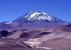
Llullaillaco volcano in Argentina and Chile, natural area of the wild Chinchilla brevicaudata.
Författare/Upphovsman: John Biggar, Licens: CC BY-SA 3.0
Antofalla at sunset from the north
(c) Bachelot Pierre J-P, CC BY-SA 3.0
Socompa volcano (6031m) seen from the northwest, from road B-241, Antofagasta Region, Chile
Författare/Upphovsman: Dantemojarrita, Licens: CC BY-SA 3.0
Patagonia hermosa
Författare/Upphovsman: DiverDave, Licens: CC BY-SA 3.0
Cerro Tuzgle, an extinct stratovolcano in Susques Department, Jujuy Province, Argentina
Författare/Upphovsman: Alicia Nijdam, Licens: CC BY 2.0
Volcán Aracar, Salta (Argentina)
Författare/Upphovsman: Gerhard Haubold, Licens: CC BY-SA 3.0
Road to Mina Julia on Cerro Escorial (5400 m ASL, center background )
A complex of snow-covered cones (left-center) partially fills the 30 x 45 km wide Caldera del Atuel, which lies just east of the Argentina-Chile border. The headwaters of the Río del Atuel drain to the SE through a wide breach in the caldera rim (top center) in this NASA International Space Station image (with north to the bottom left). The snow-covered Volcán Overo and Sosneado complexes in the eastern part of the caldera contain numerous very youthful basaltic-to-andesitic pyroclastic cones and lava flows.
Författare/Upphovsman: Éric Depagne, Licens: CC BY-SA 3.0
Laguna Verde in Chile.
The small stratovolcano surrounded by an apron of lava flows in the center of this NASA Landsat image (with north to the top) is Cochiquito volcano, Argentina. The alkaline basaltic volcano has eight satellitic cones and lies near the junction of the Río Barrancas (cutting diagonally across the image from the upper left) and the Río Grande (right-center). Lava flows from the Sillanegra pyroclastic cone complex can be seen across the Río Grande below and to the right of Cochiquito.
Författare/Upphovsman: Gerhard Haubold, Licens: CC BY-SA 3.0
View from top of deposit towards vulcano Lastarria (5670 m ASL)
Författare/Upphovsman: Damian Bikiel, Licens: CC BY-SA 4.0
Payún Matrú volcano. Mendoza, Argentina.
The Cerro Bayo volcanic complex lies along the Chile-Argentina border east of the Salar de Gorbea, the light-colored area at the left-center portion of this NASA Landsat image. A young well-preserved crater can be seen NE of an older snow-covered center (bottom-center). A younger northern center along the national border has a well-preserved 400-m-wide crater. The 5401-m-high summit of the Cerro Bayo complex, located west of the border in Chile, is the source of two viscous dacitic lava flows with prominent levees that traveled to the north.


