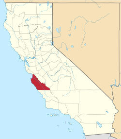
Lista över countyn i Kalifornien

I den amerikanska delstaten Kalifornien finns 58 countyn.[1]
Kaliforniens delstatskonstitution föreskiver särskilda roller för ett county och det finns två varanter: general law county och charter county.[2] Skillnaden är att ett charter county har antagit stadgar (engelska: charter), som godkänts av delstaten, och som ger en större grad av självstyre, men ingen utökad beskattningsrätt.[2] Stadgarna kan dock återkallas av delstaten.[2]
I samtliga kaliforniska countyn finns tre folkvalda befattningshavare: assessor, distriktsåklagare samt sheriff.[2]
| Namn | Centralort (County Seat) | Grundat | Typ av county | Karta | Ref |
|---|---|---|---|---|---|
| Alameda County | Oakland | 1853 | charter county | 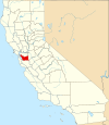 | [2] |
| Alpine County | Markleeville | 1864 | general law county |  | |
| Amador County | Jackson | 1854 | general law county | 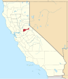 | |
| Butte County | Oroville | 1850 | charter county |  | |
| Calaveras County | San Andreas | 1850 | general law county |  | |
| Colusa County | Colusa | 1850 | general law county |  | |
| Contra Costa County | Martinez | 1850 | general law county |  | |
| Del Norte County | Crescent City | 1857 | general law county |  | |
| El Dorado County | Placerville | 1850 | charter county |  | |
| Fresno County | Fresno | 1856 | charter county |  | |
| Glenn County | Willows | 1891 | general law county | 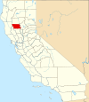 | |
| Humboldt County | Eureka | 1853 | general law county |  | |
| Imperial County | El Centro | 1907 | general law county |  | |
| Inyo County | Independence | 1866 | general law county | 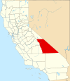 | |
| Kern County | Bakersfield | 1866 | general law county | 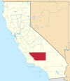 | |
| Kings County | Hanford | 1893 | general law county |  | |
| Lake County | Lakeport | 1861 | general law county |  | |
| Lassen County | Susanville | 1864 | general law county |  | |
| Los Angeles County | Los Angeles | 1850 | charter county | 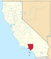 | |
| Madera County | Madera | 1893 | general law county |  | |
| Marin County | San Rafael | 1850 | general law county |  | |
| Mariposa County | Mariposa | 1850 | general law county |  | |
| Mendocino County | Ukiah | general law county | 1850 |  | |
| Merced County | Merced | general law county | 1855 |  | |
| Modoc County | Alturas | 1874 | general law county |  | |
| Mono County | Bridgeport | 1861 | general law county |  | |
| Monterey County | Salinas | 1850 | general law county |  | |
| Napa County | Napa | 1850 | general law county |  | |
| Nevada County | Nevada City | 1851 | general law county |  | |
| Orange County | Santa Ana | 1889 | charter county |  | |
| Placer County | Auburn | 1851 | charter county |  | |
| Plumas County | Quincy | 1854 | general law county |  | |
| Riverside County | Riverside | 1893 | general law county | 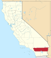 | |
| Sacramento County | Sacramento | 1850 | charter county |  | |
| San Benito County | Hollister | 1874 | general law county |  | |
| San Bernardino County | San Bernardino | 1853 | charter county |  | |
| San Diego County | San Diego | 1850 | charter county |  | |
| San Francisco | San Francisco | 1850 | charter county |  | |
| San Joaquin County | Stockton | 1850 | general law county |  | |
| San Luis Obispo County | San Luis Obispo | 1850 | general law county |  | |
| San Mateo County | Redwood City | 1856 | charter county |  | |
| Santa Barbara County | Santa Barbara | 1850 | general law county | 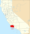 | |
| Santa Clara County | San José | 1850 | charter county | 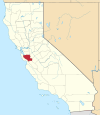 | |
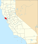
| Santa Cruz County | Santa Cruz | 1850 | general law county |  | |
| Shasta County | Redding | 1850 | general law county |  | |
| Sierra County | Downieville | 1852 | general law county |  | |
| Siskiyou County | Yreka | 1852 | general law county |  | |
| Solano County | Fairfield | 1850 | general law county |  | |
| Sonoma County | Santa Rosa | 1850 | general law county |  | |
| Stanislaus County | Modesto | 1854 | general law county | 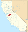 | |
| Sutter County | Yuba City | 1850 | general law county |  | |
| Tehama County | Red Bluff | 1856 | charter county |  | |
| Trinity County | Weaverville | 1850 | general law county |  | |
| Tulare County | Visalia | 1852 | general law county |  | |
| Tuolumne County | Sonora | 1850 | general law county |  | |
| Ventura County | Ventura | 1872 | general law county | 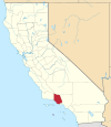 | |
| Yolo County | Woodland | 1850 | general law county |  | |
| Yuba County | Marysville | 1850 | general law county |  |
Se även
Referenser
- ^ National Association of Counties - Find a county Arkiverad 4 augusti 2010 hämtat från the Wayback Machine.
- ^ [a b c d e] ”County Structure & Powers” (på engelska). www.counties.org. California State Association of Counties. https://www.counties.org/general-information/county-structure-0#:~:text=The%20California%20Constitution%20allows%20a,power%2C%20are%20adopted%20by%20ordinance.. Läst 14 februari 2024.
Externa länkar
 Wikimedia Commons har media som rör lista över countyn i Kalifornien.
| ||||||||||
| |||||
Media som används på denna webbplats
Flag of California. This version is designed to accurately depict the standard print of the bear as well as adhere to the official flag code regarding the size, position and proportion of the bear, the colors of the flag, and the position and size of the star.
This is a locator map showing Amador County in California. For more information, see Commons:United States county locator maps.
A locator map showing Orange County — in Southern California.
A county locator map of California, with Lassen County highlighted inred.
Locator map showing San Bernardino County in Southern California.
A county locator map of California, with Del Norte County highlighted inred.
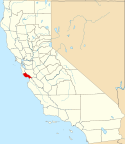
This is a locator map showing Santa Cruz County in California. For more information, see Commons:United States county locator maps.
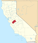
A county locator map of California, with San Joaquin County highlighted inred.
A county locator map of California, with Yuba County highlighted in red.
This is a locator map showing Santa Clara County in California. For more information, see Commons:United States county locator maps.
A county locator map of California, with Nevada County highlighted inred.
A county locator map of California, with Yolo County highlighted in red.
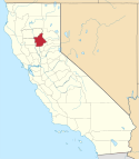
A county locator map of California, with Placer County highlighted inred.
This is a locator map showing Alameda County in California. For more information, see Commons:United States county locator maps.
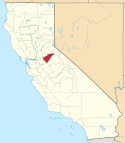
This is a locator map showing Stanislaus County in California. For more information, see Commons:United States county locator maps.
This is a locator map showing San Diego County in California. For more information, see Commons:United States county locator maps.
This is a locator map showing Calaveras County in California. For more information, see Commons:United States county locator maps.
This is a locator map showing Fresno County in California. For more information, see Commons:United States county locator maps.
This is a locator map showing Contra Costa County in California. For more information, see Commons:United States county locator maps.
A county locator map of California, with Plumas County highlighted inred.
This is a locator map showing San Luis Obispo County in California. For more information, see Commons:United States county locator maps.
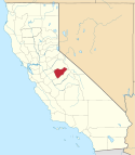
This is a locator map showing Madera County in California. For more information, see Commons:United States county locator maps.
This is a locator map showing Tuolumne County in California. For more information, see Commons:United States county locator maps.
Locator map of Solano County (highlighted in red) — in Northern California.
A county locator map of California, with Sacramento County highlighted inred.
A county locator map of California, with Lake County highlighted inred.
A locator map showing Los Angeles County — in Southern California.
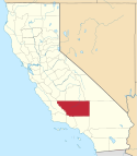
Locator map showing Kern County — in central and southern California.
A county locator map of California, with Mono County highlighted inred.
This is a locator map showing Inyo County in California. For more information, see Commons:United States county locator maps.
This is a locator map showing Merced County in California. For more information, see Commons:United States county locator maps.
This is a locator map showing Alpine County in California. For more information, see Commons:United States county locator maps.
County locator map showing Kings County — in central California.
A county locator map of California, with Siskiyou County highlighted inred.
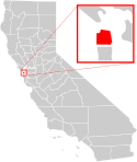
A county locator map of California, with San Francisco County highlighted and enlarged in red.
A county locator map of California, with Trinity County highlighted inred.
A county locator map of California, with El Dorado County highlighted inred.
This is a locator map showing Butte County in California. For more information, see Commons:United States county locator maps.
This is a locator map showing San Mateo County in California. For more information, see Commons:United States county locator maps.
This is a locator map showing Riverside County in California. For more information, see Commons:United States county locator maps.
A county locator map of California, with Sierra County highlighted inred.
This is a locator map showing Glenn County in California. For more information, see Commons:United States county locator maps.
A county locator map of California, with Napa County highlighted inred.
This is a locator map showing Tulare County in California. For more information, see Commons:United States county locator maps.
A county locator map of California, with Colusa County highlighted inred.
This is a locator map showing Santa Barbara County in Southern California.
This is a locator map showing Marin County in California. For more information, see Commons:United States county locator maps.
A county locator map of California, with Sonoma County highlighted inred.
A county locator map of California, with Tehama County highlighted inred.
A county locator map of California, with Sutter County highlighted inred.
A county locator map of California, with Shasta County highlighted inred.
This is a locator map showing San Benito County in California. For more information, see Commons:United States county locator maps.
A county locator map of California, with Humboldt County highlighted inred.
A county locator map of California, with Mendocino County highlighted inred.


