Lista över öar i Medelhavet
Detta är en lista över öar i Medelhavet.
Lista över öar efter area
Se även
Referenser
Noter
- ^ "Sicily". Encyclopædia Britannica. Encyclopædia Britannica Ultimate Reference Suite. Chicago: Encyclopædia Britannica, 2015.
- ^ [a b] ”Statistiche demografiche ISTAT”. demo.istat.it. Arkiverad från originalet den 3 maj 2017. https://web.archive.org/web/20170503222520/http://demo.istat.it/pop2016/index_e.html. Läst 4 maj 2017.
- ^ "Sardinia". Encyclopædia Britannica. Encyclopædia Britannica Ultimate Reference Suite. Chicago: Encyclopædia Britannica, 2015.
- ^ [a b] ”The World Factbook”. cia.gov. Arkiverad från originalet den 30 maj 2015. https://web.archive.org/web/20150530024659/https://www.cia.gov/library/publications/resources/the-world-factbook/geos/cy.html. Läst 4 maj 2017.
- ^ "Corsica". Encyclopædia Britannica. Encyclopædia Britannica Ultimate Reference Suite. Chicago: Encyclopædia Britannica, 2015.
- ^ [a b c d e f g h i j k l m n o p q r s t u v w x y z aa ab ac ad ae af ag ah ai aj ak al am an ao ap aq ar as at au av aw ax ay az ba bb bc bd be bf bg bh bi bj bk bl bm bn bo bp bq br bs bt bu bv bw bx by bz ca cb cc cd ce cf cg ch ci cj ck cl cm cn co cp cq cr cs ct cu cv cw cx cy cz da db dc dd de df dg dh di dj dk dl dm dn do dp dq dr ds dt du dv dw dx dy dz ea eb ec ed ee ef eg eh ei ej ek el em en eo ep eq er es et eu ev ew ex ey ez fa fb fc fd fe ff fg fh fi fj fk fl fm fn fo fp fq fr fs ft fu fv fw fx fy fz ga gb gc gd ge gf gg gh gi gj gk] Statistical Yearbook of Greece 2009 & 2010, Hellenic Statistical Authority, 2010. Läst 4 maj 2017.
- ^ "Majorca". Encyclopædia Britannica. Encyclopædia Britannica Ultimate Reference Suite. Chicago: Encyclopædia Britannica, 2015.
- ^ [a b c d] ”BOE-A-2015-13745.pdf”. BOE.es. http://www.boe.es/boe/dias/2015/12/17/pdfs/BOE-A-2015-13745.pdf. Läst 4 maj 2017.
- ^ "Minorca". Encyclopædia Britannica. Encyclopædia Britannica Ultimate Reference Suite. Chicago: Encyclopædia Britannica, 2015.
- ^ "Ibiza". Encyclopædia Britannica. Encyclopædia Britannica Ultimate Reference Suite. Chicago: Encyclopædia Britannica, 2015.
- ^ [a b] "Jerba". Encyclopædia Britannica. Encyclopædia Britannica Ultimate Reference Suite. Chicago: Encyclopædia Britannica, 2015.
- ^ [a b c d e f g h i j k l m n o p q r s t u v w x y z aa ab ac ad ae af ag ah ai aj ak al am an ao ap aq ar as at au av aw ax ay az ba bb bc bd be bf bg bh bi bj bk bl bm bn bo bp bq br bs bt bu bv bw bx by bz ca cb cc cd ce cf cg ch] Ostroški, Ljiljana: Statistical Yearbook of the Republic of Croatia 2015, Croatian Bureau of Statistics, 2015. Läst 4 maj 2017.
- ^ "Gökçeada". Encyclopædia Britannica. Encyclopædia Britannica Ultimate Reference Suite. Chicago: Encyclopædia Britannica, 2015.
- ^ ”GÖKÇEADA NÜFUSU, ÇANAKKALE”. Nufusune.com. http://www.nufusune.com/gokceada-ilce-nufusu-canakkale. Läst 4 maj 2017.
- ^ [a b c] ”Malta_in_Figures_2014.pdf”. nso.gov.mt. Arkiverad från originalet den 7 januari 2018. https://web.archive.org/web/20180107055029/https://nso.gov.mt/en/publicatons/Publications_by_Unit/Documents/D2_Dissemination_Unit/Malta_in_Figures_2014.pdf. Läst 4 maj 2017.
- ^ [a b] ”Demographic_Review_2014.pdf”. nso.gov.mt. Arkiverad från originalet den 25 maj 2017. https://web.archive.org/web/20170525074933/https://nso.gov.mt/en/publicatons/Publications_by_Unit/Documents/C3_Population_and_Tourism_Statistics/Demographic_Review_2014.pdf. Läst 4 maj 2017.
- ^ "Elba". Encyclopædia Britannica. Encyclopædia Britannica Ultimate Reference Suite. Chicago: Encyclopædia Britannica, 2015.
- ^ ”Elba Facts”. WorldAtlas.com. http://www.worldatlas.com/webimage/countrys/europe/elba/itelbafacts.htm. Läst 4 maj 2017.
- ^ [a b] "Sant'Antioco Island". Encyclopædia Britannica. Encyclopædia Britannica Ultimate Reference Suite. Chicago: Encyclopædia Britannica, 2015.
- ^ ”Background”. FormenteraGuide.com. Arkiverad från originalet den 19 oktober 2017. https://web.archive.org/web/20171019214403/http://www.formenteraguide.com/formentera-island/. Läst 4 maj 2017.
- ^ [a b] "Pantelleria Island". Encyclopædia Britannica. Encyclopædia Britannica Ultimate Reference Suite. Chicago: Encyclopædia Britannica, 2015.
- ^ "Asinara Island". Encyclopædia Britannica. Encyclopædia Britannica Ultimate Reference Suite. Chicago: Encyclopædia Britannica, 2015.
- ^ [a b] ”Information about San Pietro, Italy”. MediterraneanIslands.org. http://www.mediterraneanislands.org/island.php?island=san-pietro. Läst 4 maj 2017.
- ^ "Ischia, Island of". Encyclopædia Britannica. Encyclopædia Britannica Ultimate Reference Suite. Chicago: Encyclopædia Britannica, 2015.
- ^ ”Bozcaada Nüfusu Çanakkale”. Nufusu.com. http://www.nufusu.com/ilce/bozcaada_canakkale-nufusu. Läst 4 maj 2017.
- ^ "Giglio Island". Encyclopædia Britannica. Encyclopædia Britannica Ultimate Reference Suite. Chicago: Encyclopædia Britannica, 2015.
- ^ "Lampedusa Island". Encyclopædia Britannica. Encyclopædia Britannica Ultimate Reference Suite. Chicago: Encyclopædia Britannica, 2015.
- ^ "Vulcano Island". Encyclopædia Britannica. Encyclopædia Britannica Ultimate Reference Suite. Chicago: Encyclopædia Britannica, 2015.
- ^ "Maddalena Island". Encyclopædia Britannica. Encyclopædia Britannica Ultimate Reference Suite. Chicago: Encyclopædia Britannica, 2015.
- ^ "Capraia Island". Encyclopædia Britannica. Encyclopædia Britannica Ultimate Reference Suite. Chicago: Encyclopædia Britannica, 2015.
- ^ "Egadi Islands". Encyclopædia Britannica. Encyclopædia Britannica Ultimate Reference Suite. Chicago: Encyclopædia Britannica, 2015.
- ^ "Caprera Island". Encyclopædia Britannica. Encyclopædia Britannica Ultimate Reference Suite. Chicago: Encyclopædia Britannica, 2015.
- ^ "Montecristo Island". Encyclopædia Britannica. Encyclopædia Britannica Ultimate Reference Suite. Chicago: Encyclopædia Britannica, 2015.
- ^ "Stromboli Island". Encyclopædia Britannica. Encyclopædia Britannica Ultimate Reference Suite. Chicago: Encyclopædia Britannica, 2015.
- ^ "Capri, Island of". Encyclopædia Britannica. Encyclopædia Britannica Ultimate Reference Suite. Chicago: Encyclopædia Britannica, 2015.
- ^ "Pianosa Island". Encyclopædia Britannica. Encyclopædia Britannica Ultimate Reference Suite. Chicago: Encyclopædia Britannica, 2015.
- ^ [a b c d e f g h i j k l m n o p q r] ”Duplancic_Cala_Ujevic_9_1-1.pdf”. Academa.si. Arkiverad från originalet den 4 augusti 2016. https://web.archive.org/web/20160804095537/http://www.academa.si/zff/Duplancic_Cala_Ujevic_9_1-1.pdf. Läst 4 maj 2017.
- ^ ”Comino Island In Malta Has A Blue Lagoon. And It's Kind Of Heaven”. HuffingtonPost.com. http://www.huffingtonpost.com/2014/08/08/comino-island-in-malta-ha_n_5647511.html. Läst 4 maj 2017.
Källor
- Statistical Yearbook of Greece 2009 & 2010, Pireus: Hellenic Statistical Authority, 2010 (publicerad 2012), s. 28, 46–47, ISSN 0081-5071, OCLC 604943027, http://dlib.statistics.gr/Book/GRESYE_01_0002_00061.pdf
- Ostroški, Ljiljana (EIC) (2015), Statistical Yearbook of the Republic of Croatia 2015, Zagreb: Croatian Bureau of Statistics, s. 47, ISSN 1333-3305, OCLC 883994482, http://www.dzs.hr/Hrv_Eng/ljetopis/2015/sljh2015.pdf
Media som används på denna webbplats
Det är enkelt att lägga till en ram runt den här bilden
Författare/Upphovsman: Eric Gaba (original author), User:Historicair (locator map), Ferengi (cropping, removal of labels), Licens: CC BY-SA 3.0
Map of Naxos Island
Författare/Upphovsman: Olivier Brunet, Licens: CC BY-SA 3.0
Vue aérienne de l'ile de Pianosa, dans l'archipel Toscan en Italie
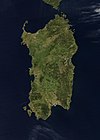
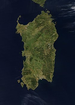
Credit Jeff Schmaltz, MODIS Rapid Response Team, NASA/GSFC The island of Sardinia sits between the Mediterranean Sea to the south and west and the Tyrrhenian Sea to the east. To its immediate north is the island of Corsica, which is a part of France. To the east of Sardinia is the middle of the Italian peninsula (not shown). Sardinia glows here with the green blush of spring.
Sardinia has had a tumultuous history. Starting in ancient times, the island was occupied by Phoenicians, Carthaginians, and Romans; thereafter it was controlled by Vandals, Byzantines, and a long string of rulers of Italian city-states. In the late 15th century, Sardinia came under the control of Spain, then in the early 18th century was passed to the Austrians. It briefly fell to Spanish occupation in 1717, but by 1720 was given over again to the control of Italian rule. This true-color Aqua MODIS image was acquired on April 27, 2003.Map of Gőkceada
Greek Island Skyros from space
Författare/Upphovsman: Dimorsitanos, Licens: CC BY-SA 3.0 gr
Map of Antiparos island, Greece
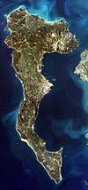
Satelite image of Zirje island, Croatia.
Författare/Upphovsman: Jacques Descloitres, MODIS Rapid Response Team, NASA/GSFC, Licens: CC0
Kos Island
Greek Island Angistri from space
Greek Island Andros from space
Författare/Upphovsman:
- Aegina_general_map-de.svg: Uwe Dedering
- derivative work: Uwe Dedering (talk)
Map of the island Aegina, Greece. Equirectangular projection. Strechted by 125.0%. Geographic limits of the map: * N: 37.8° N * S: 37.65° N * W: 23.4° E * E: 23.6° E Relief: SRTM3 V2 for land and ETOPO1 for water. Coastline and streets: OSM Names and locations: GeoNames
Författare/Upphovsman: Luca Siragusa, Licens: CC BY 2.0
Lampedusa island, Italy, part of the Pelagie Islands located in the central part of the Mediterranean Sea between Europe and Africa.
Författare/Upphovsman: European Space Agency, Licens: CC BY-SA 3.0 igo
This image of Malta, captured by the Copernicus Sentinel-2B satellite is one of the first set of images delivered via Alphasat, which is in geostationary orbit 36 000 km above Earth. The image is a result of the two satellites using their optical communication instruments to transfer data via laser for fast delivery. This is essential for applications such as helping respond to disasters.
Satellite picture of Cabrera Archipelago National Park — in the Balearic Islands, Spain.
Satellite image of Skopelos, Greek island in the Aegean sea
Författare/Upphovsman: Denna fil har laddats upp med Commonist., Licens: CC BY-SA 3.0
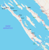
Island of Lastovo and surrounding islets
Författare/Upphovsman: Sudika, Licens: CC BY-SA 3.0
Bird's eye view of Kemmuna (Comino) island, Malta
Satellite image of Sicily
This true-color scene of a smoke plume streaming eastward from snow-capped Mount Etna was acquired on April 7, 2002, by the Moderate-resolution Imaging Spectroradiometer (MODIS), aboard NASA's Terra satellite. Mount Etna, towering above Catania, Sicily's second largest city, has one of the world's longest documented records of historical volcanism, dating back to 1500 BC. Historical lava flows cover much of the surface of this massive basaltic stratovolcano, the highest and most voluminous in Italy.Författare/Upphovsman:
The original uploader was Frente på tyska Wikipedia.
Luftbild der Insel Dia
Greek Island Euboea from space
Ischia Island
Författare/Upphovsman: Bourrichon - fr:Bourrichon, Licens: CC BY-SA 3.0
Topographic and administrative map in French of Porquerolles
Map of the island of w:Astypalaia (Stampalia) in Greece, created in 1597 by the Venetian Giacomo (Jacomo) Franco (1550-1620) for his book Viaggio da Venetia a Constantinopoli per Mare.
Sattelite image of Majorca
(c) User: Bgabel at wikivoyage shared, CC BY-SA 3.0
Karte der Kykladen-Insel Ios, Umriss von OSM
Författare/Upphovsman: C messier, Licens: CC BY-SA 3.0
The island of Serifos as seen from above.
(c) User: Bgabel at wikivoyage shared, CC BY-SA 3.0
Karte der griechischen Insel Ikaria
Chios, or Khios, Island, Greece Located in the eastern Aegean Sea just off the coast of western Turkey, the Greek island of Chios can be seen in this near-nadir view. Chios Island is 30 miles (48 km) long and 8 to 15 miles (13 to 24 km) wide and covers an area of 350 sq. miles (905 sq. km). The island is hilly, scenic, and fertile with a good climate. Chios produces olives, figs, and mastic and has marble quarries, lignite deposits, and sulfur springs. Chios is noted in antiquity for its claims as Homer's birthplace and for its school of epic poets, the Homeridae. The land visible at the right center and top right is part of the country of Turkey.
Photographie de Kéa et Makronissos depuis la Station Spatiale Internationale - Résolution supérieure.
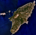
Visible colour satellite image of Rhodes.
Författare/Upphovsman: Cédric Boissière à partir du fond de carte / from Blank map of the Cyclades, Greece de/of Sting, Licens: CC BY 3.0
Villes et villages principaux de Paros / Principal towns and villages of Paros
(c) User: Bgabel at wikivoyage shared, CC BY-SA 3.0
Karte der Kykladeninsel Mykonos
Författare/Upphovsman: Toksave, Licens: CC BY-SA 3.0
Marmara Island, Turkey (Marmara Sea)
Författare/Upphovsman: Toksave, Licens: CC BY-SA 3.0
Avşa Island (also known as Türkeli island), Turkey (located in the Marmara Sea)
Lesbos Island, Greece - September/October 1995
Greek Island Moni from space
Författare/Upphovsman: Mihai mad, Licens: CC BY-SA 3.0
Sazan Island map in english
Författare/Upphovsman: © OpenStreetMap contributors, cropped by myself, Licens: CC BY-SA 2.0
Map of Pakleni otoci and Hvar
The western and central parts of Crete appear surrounded by quicksilver in this astronaut photograph taken from the International Space Station. This phenomenon is known as sunglint, caused by light reflecting off of the sea surface directly toward the observer. The point of maximum reflectance is visible as a bright white region to the north-west of the island. Surface currents causing variations in the degree of reflectance are visible near the south-western shoreline of Crete and the smaller island of Gavdos (image lower left).
Författare/Upphovsman: Oyoyoy, Licens: CC BY-SA 3.0
Saria Island (Greek: Σαρία) is an island in Greece, along the northern edge of Karpathos, separated from it by a strait 100 m (330 ft) wide. Photo taken in flight.
Författare/Upphovsman: Mjobling, Licens: CC BY 3.0
Aerial view of the island of Elba
Satellite image of Silba
Författare/Upphovsman: Morn the Gorn
compass rose from Maps_template-fr.svg: Eric Gaba (Sting - fr:Sting)
Road and rail data from OpenStreetMap, Licens: CC BY-SA 3.0
Map of Capri. Uses terrain data from SRTM3 (http://dds.cr.usgs.gov/srtm/version2_1/SRTM3/Eurasia/N40E014.hgt.zip).
Bitmap version of File:Capri_sights_terrain.svg.
(c) User: Gobbler at wikivoyage shared, CC BY-SA 2.0
Cartina dell'isola di Dugi Otok in Italiano
Författare/Upphovsman: C messier, Licens: CC BY-SA 3.0
Sifnos island airview from west. Altitude around 9 km. The atmosphere was quite dusty and as a result there is a white belt on the horizon
Författare/Upphovsman: Olaf Tausch, Licens: CC BY 3.0
Insel Syros (Σύρος), Gemeinde Syros-Ermoupoli, Kykladen, südliche Ägäis, Griechenland
Författare/Upphovsman: OpenStreetMap/OpenCycleMap + Geraki, Licens: CC BY-SA 3.0
Τοπογραφικός χάρτης της Σαμοθράκης
Författare/Upphovsman: Chrischerf, Licens: CC BY-SA 3.0
Aerial view of the Island Tilos (Greece).
Författare/Upphovsman: MrPanyGoff, Licens: CC BY-SA 4.0
Biševo island seen from the airplane. Located in the Adriatic Sea close to the Island of Vis, not far from the city of Split, Croatia.
Författare/Upphovsman: Sky Eckstrom, Licens: CC BY-SA 2.0
Aerial view of Isola del Giglio, looking from the North East
(c) User: Mediterranean.web at wikivoyage shared, CC BY-SA 3.0
Luftbild Insel Pantelleria
Författare/Upphovsman: User:FocalPoint, Licens: CC BY-SA 3.0
Grecka wyspa Makronisos, przedstawiona tak, jak widywana jest również podczas lotów rejsowych z Polski. Zdjęcie wykonano w momencie zwrotu samolotu, czyli niezwłocznie po minięciu przylądka Sounio. Po lewej stronie fotografii widoczny jest brzeg Attyki, na nim m.in. zewnętrzne fragmenty portu dalekomorskiego w Lawrio. U góry fotografii, czyli już z tyłu za samolotem, oddala się wyspa Evia (Eubea).
Mission: ISS017 Roll: E Frame: 12893 Mission ID on the Film or image: ISS017
Country or Geographic Name: CRETE
Features: GAVDOS ISLAND
Center Point Latitude: 34.8 Center Point Longitude: 24.1 (Negative numbers indicate south for latitude and west for longitude)
- Image Science and Analysis Laboratory, NASA-Johnson Space Center. "The Gateway to Astronaut Photography of Earth."
- <http://eol.jsc.nasa.gov/scripts/sseop/photo.pl?mission=ISS017&roll=E&frame=12893> (10/03/2009 17:27:00) .
- Send questions or comments to the NASA Responsible Official at jsc-earthweb@mail.nasa.gov
- Curator: Earth Sciences Web Team
- Notices: Web Accessibility and Policy Notices, NASA Web Privacy Policy
Författare/Upphovsman: Ingen maskinläsbar skapare angavs. NormanEinstein antaget (baserat på upphovsrättsanspråk)., Licens: CC BY-SA 3.0
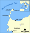
A map of Asinara island off the northwest coast of Sardinia, Italy.
Created by NormanEinstein, July 15, 2005.Författare/Upphovsman: Salvatore88, Licens: CC BY 2.0
Monte Fossa delle Felci e Monte dei Porri (Salina, Sicilia, Italia)
Milazzo 2005 301
NASA astronaut image of Bozcaada Island (Turkey) in Aegean Sea.
Satellitenbild der Griechischen Insel Thasos, vor der Makedonisch-Thrakischen Küste; Lage der Ortschaft Limenaria auf der Griechischen Insel Thasos.
Satellite image of Skiathos, Greek island in the Aegean sea
The island of Ibiza, by astronaut photograph ISS035-E-7431 was acquired on March 22, 2013, with a Nikon D3S digital camera using a 400 millimeter lens, and is provided by the ISS Crew Earth Observations experiment and Image Science & Analysis Laboratory, Johnson Space Center. The image was taken by the Expedition 35 crew. It has been cropped and enhanced to improve contrast, and lens artifacts have been removed. The International Space Station Program supports the laboratory as part of the ISS National Lab to help astronauts take pictures of Earth that will be of the greatest value to scientists and the public, and to make those images freely available on the Internet. Additional images taken by astronauts and cosmonauts can be viewed at the NASA/JSC Gateway to Astronaut Photography of Earth.
Författare/Upphovsman: Simon Reinhardt, Licens: CC BY-SA 3.0
Aerial view of the Greek island of Folegandros taken from a plane on a flight from Mykonos to Crete (Chania airport).
Approximate map of Brač Island, based on several images maps

