Linden, Bern
| Linden | ||
| tyska: Gemeinde Linden | ||
| Kommun | ||
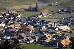
Vy över Linden | ||
| ||
| Land | ||
|---|---|---|
| Kanton | Bern | |
| Distrikt | Bern-Mittelland | |
| Höjdläge | 916 m ö.h. | |
| Koordinater | 46°50′55″N 07°40′38″Ö / 46.84861°N 7.67722°Ö | |
| Yta | 13,23 km²[1] | |
| Folkmängd | 1 257 (2023-12-31)[2] | |
| Befolkningstäthet | 95 inv./km² | |
| Tidszon | CET (UTC+1) | |
| - sommartid | CEST (UTC+2) | |
| Postnummer | 3673 | |
| Kommunkod | 0614 | |
| Geonames | 7286356 | |
| Språk | Tyska | |
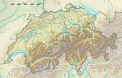
Lindens läge i Schweiz | ||
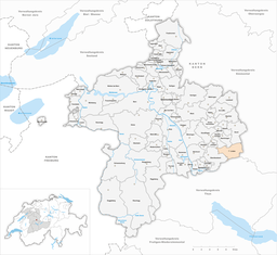
Detaljkarta kommunindelning | ||
| Webbplats: http://www.linden.ch | ||
Linden är en ort och kommun i distriktet Bern-Mittelland i kantonen Bern, Schweiz. Kommunen har 1 257 invånare (2023).[2]
Referenser
- ^ ”Arealstatistik Standard - Gemeinden nach 4 Hauptbereichen” (på tyska/franska). Bundesamt für Statistik. 25 november 2021. https://dam-api.bfs.admin.ch/hub/api/dam/assets/19805706/master.
- ^ [a b] ”Bilanz der ständigen Wohnbevölkerung nach Bezirken und Gemeinden, 1991-2023” (på tyska/franska/italienska/engelska). Bundesamt für Statistik. 22 augusti 2024. https://www.bfs.admin.ch/asset/de/32229243.
Externa länkar
 Wikimedia Commons har media som rör Linden.
Media som används på denna webbplats
Författare/Upphovsman: Eric Gaba (Sting - fr:Sting) and NordNordWest, Licens: CC BY-SA 3.0
Blank physical map of Switzerland, for geo-location purpose. More maps: → Maps of Switzerland.
Shiny red button/marker widget. Used to mark the location of something such as a tourist attraction.
Författare/Upphovsman: Aliman5040, Licens: CC BY-SA 3.0
coat of arms municipality of Linden (Switzerland)
Författare/Upphovsman: René Edward Knupfer-Müller, Licens: CC BY-SA 4.0
Linden (BE) – Ortskern, Blick vom Aebersold aus – Aufnahmestandort : Oberhünigen, Aebersold (Kurzenberg), Brotheitern – 46° 51’ 27’’ N / 7° 40’ 29’’ E – 1133 m; Blickrichtung Süd
Författare/Upphovsman: Tschubby, Licens: CC BY-SA 3.0
Municipality Linden


