Linares
Linares kan syfta på
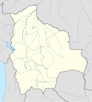
Bolivia
- Provincia Linares, provins, Potosí, 19°50′00″S 65°30′00″V / 19.83333°S 65.5°V
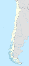
Chile
- Linares (kommun i Chile), 35°57′29″S 71°19′55″V / 35.95814°S 71.33207°V
- Linares (ort i Chile, Región del Maule, Provincia de Linares, lat -35,85, long -71,59), 35°50′48″S 71°35′35″V / 35.84667°S 71.59308°V
Colombia
- Linares (kommun i Colombia, Nariño, lat 1,40, long -77,54), 1°24′02″N 77°32′39″V / 1.40053°N 77.54422°V
- Linares (ort i Colombia, Nariño, lat 1,36, long -77,53), 1°21′28″N 77°31′38″V / 1.35783°N 77.52725°V
Mexiko
- Linares (kommun i Mexiko, Nuevo León, lat 24,86, long -99,56), 24°51′48″N 99°33′51″V / 24.86323°N 99.56411°V
- Linares, Nuevo León, ort, 24°51′29″N 99°34′04″V / 24.85798°N 99.56768°V
- Linares, San Luis Potosí, ort, Tancanhuitz, 21°39′38″N 98°56′25″V / 21.66069°N 98.94018°V
- Linares, Zacatecas, ort, Loreto, 22°14′42″N 102°01′08″V / 22.245°N 102.01889°V
Spanien
- Linares (kommunhuvudort), Andalusien, Provincia de Jaén, 38°05′43″N 3°38′10″V / 38.09519°N 3.63602°V
- Linares de Riofrío, Kastilien och Leon, Provincia de Salamanca, 40°35′00″N 5°55′15″V / 40.58338°N 5.92091°V
- Linares de Mora, Aragonien, Provincia de Teruel, 40°19′18″N 0°34′29″V / 40.32159°N 0.57468°V
- Linares, Jaén, 38°05′50″N 3°38′40″V / 38.09734°N 3.64455°V
Media som används på denna webbplats
Shiny blue button/marker widget.
Författare/Upphovsman: NordNordWest, Licens: CC BY-SA 3.0
Location map of Chile
Författare/Upphovsman: Sémhur, Licens: CC BY-SA 4.0
Map of Mexico, with states borders.
Författare/Upphovsman: NordNordWest, Licens: CC BY-SA 3.0
Location map of Spain
Equirectangular projection, N/S stretching 130 %. Geographic limits of the map:
- N: 44.4° N
- S: 34.7° N
- W: 9.9° W
- E: 4.8° E
Logo for disambiguation pages.
Författare/Upphovsman: NordNordWest, Licens: CC BY-SA 3.0
Location map of Bolivia


