Limoux
| Limoux | ||
| Kommun | ||
 | ||
| ||
| Land | ||
|---|---|---|
| Region | Occitanien | |
| Departement | ||
| Arrondissement | Limoux | |
| Kanton | Limoux | |
| Koordinater | 43°4′N 2°14′Ö / 43.067°N 2.233°Ö | |
| Yta | 32,41 km²[1] | |
| Folkmängd | 10 339 ()[2] | |
| Befolkningstäthet | 319 invånare/km² | |
| Borgmästare | Jean-Paul Dupré | |
| Tidszon | CET (UTC+1) | |
| - sommartid | CEST (UTC+2) | |
| Postnummer | 11300 | |
| INSEE | 11206 | |
| Geonames | 2998264 | |
| OSM-karta | 37775 | |
 Kommunens läge i regionen Occitanien i Frankrike. | ||
| Webbplats: https://www.limoux.fr | ||

Limoux är en kommun i departementet Aude i regionen Occitanien i södra Frankrike. Kommunen ligger i kantonen Limoux som ligger i arrondissementet Limoux. År 2022 hade Limoux 10 339 invånare.
Befolkningsutveckling
Antalet invånare i kommunen Limoux
Referens: INSEE[3]
Galleri


 Karnevalen
Se även
Källor
- ^ Répertoire géographique des communes, Institut national de l'information géographique et forestière, läst: 26 oktober 2015.[källa från Wikidata]
- ^ Populations légales 2022, Institut National de la Statistique et des Études Économiques, 19 december 2024.[källa från Wikidata]
- ^ Chiffres clés - Évolution et structure de la population Arkiverad 5 juli 2012 hämtat från the Wayback Machine.
Media som används på denna webbplats

Författare/Upphovsman: Eric Gaba (Sting - fr:Sting), Licens: CC BY-SA 4.0
Blank physical map of metropolitan France for geo-location purpose.
Scale : 1:14 816 000 (accuracy : about 3,7 km) for the bathymetry. More maps of France, view → Commons Atlas of France.

Shiny red button/marker widget. Used to mark the location of something such as a tourist attraction.

Författare/Upphovsman: tagon from France, Licens: CC BY 2.0
Pierrots du Carnaval de Limoux dans l'Aude en France
.svg)

Författare/Upphovsman: Pinpin, Licens: CC BY-SA 3.0
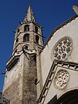
Limoux (Aude, Languedoc-Roussillon, France) - Lycée Jacques Ruffié.

Blason (non-officiel attendu que ce département ne revendique pas de blason) du département de l'Aude : de gueules à la croix cléchée, vidée et pommetée de douze pièces d’or, à la bordure crénelée d’argent
Författare/Upphovsman:
|
Map data (c) OpenStreetMap contributors, CC-BY-SA _French_municipality_map.svg) • Shape files infrastructure: railway, highways, water: all originally by OpenStreetMap contributors. Status december 2011 *note: shown commune boundaries are from OSM dump May 2012; at that time about 90% complete |
Map commune FR insee code 11206.png

Författare/Upphovsman: Pinpin, Licens: CC BY-SA 3.0
France, Aude (11), Limoux, Gare
Författare/Upphovsman: Pinpin, Licens: CC BY-SA 3.0
Place de la République à Limoux (Aude, France).

Författare/Upphovsman: Pinpin (diskussion · bidrag), Licens: CC BY-SA 3.0
Siège de la communauté de commune du Limouxin et Saint-hilairois à Limoux (Aude, France).

Författare/Upphovsman: --Pinpin 18:59, 24 March 2007 (UTC), Licens: CC BY-SA 3.0
Pont-Neuf de Limoux
