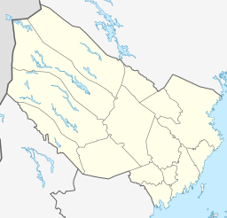
Lill-Björkvattnet, Lappland

Lill-Björkvattnet
Insjö
Flygfoto över Lill-Björkvattnet och Voijtjajaure kapell
(c) Jan Norrman / Riksantikvarieämbetet, CC BY 2.5
Flygfoto över Lill-Björkvattnet och Voijtjajaure kapell
Geografiskt läge
LandSverige Sverige
LänVästerbottens län
KommunStorumans kommun
LandskapLappland
SockenTärna socken
Koordinater 
  WGS 8465°29′22″N 15°35′28″Ö / 65.48935°N 15.59112°Ö / 65.48935; 15.59112 (Lill-Björkvattnet, Lappland)
  SWEREF 99 TM7263122, 527364
Mått
Areal8,25 km² [1]
Höjd378,1 m ö.h. [1]
Medeldjup16,7 m [2]
Maxdjup49,2 m [2]
Volym137 600 000 m³ [2]
Flöden
Huvudavrinnings­områdeUmeälvens huvudavrinningsområde (28000)
Övrigt
SjöID726529-149010
Limnisk ekoregionNorrlands inland, under trädgränsen över högsta kustlinjen

Lill-Björkvattnet är en sjö i Storumans kommun i Lappland och ingår i Björkvattsdalen i Umeälvens huvudavrinningsområde. Sjön är 49,2 meter djup, har en yta på 8,25 kvadratkilometer och är belägen 378,1 meter över havet.

Se även

Källor

Externa länkar

Media som används på denna webbplats

Red pog.svg
Shiny red button/marker widget. Used to mark the location of something such as a tourist attraction.
Portable brun.png
Författare/Upphovsman: Mikadiou, Licens: CC BY-SA 3.0
opened laptop computer, brown screen
Lill-Björkvattnet 22 juni 2024 bild 4.jpg
Författare/Upphovsman:

This image was produced by me, David Castor (user:dcastor). The pictures I submit to the Wikipedia Project are released to the public domain. This gives you the right to use them in any way you like, without any kind of notification. This said, I would still appreciate to be mentioned as the originator whenever you think it complies well with your use of the picture. A message to me about how it has been used would also be welcome. You are obviously not required to respond to these wishes of mine, just in a friendly manner encouraged to. (All my photos are placed in Category:Images by David Castor or a subcategory thereof.)

, Licens: CC0
Lill-Björkvattnet i Lappland
Sweden Västerbotten location map.svg
Författare/Upphovsman: Erik Frohne, Licens: CC BY-SA 3.0
Location map of Västerbotten county in Sweden

Equirectangular projection, N/S stretching 235 %. Geographic limits of the map:

  • N: 66.40° N
  • S: 63.30° N
  • W: 14.10° E
  • E: 21.70° E
Lill-Björkvattnet 22 juni 2024 bild 1.jpg
Författare/Upphovsman:

This image was produced by me, David Castor (user:dcastor). The pictures I submit to the Wikipedia Project are released to the public domain. This gives you the right to use them in any way you like, without any kind of notification. This said, I would still appreciate to be mentioned as the originator whenever you think it complies well with your use of the picture. A message to me about how it has been used would also be welcome. You are obviously not required to respond to these wishes of mine, just in a friendly manner encouraged to. (All my photos are placed in Category:Images by David Castor or a subcategory thereof.)

, Licens: CC0
Lill-Björkvattnet i Lappland
Lill-Björkvattnet 22 juni 2024 bild 3.jpg
Författare/Upphovsman:

This image was produced by me, David Castor (user:dcastor). The pictures I submit to the Wikipedia Project are released to the public domain. This gives you the right to use them in any way you like, without any kind of notification. This said, I would still appreciate to be mentioned as the originator whenever you think it complies well with your use of the picture. A message to me about how it has been used would also be welcome. You are obviously not required to respond to these wishes of mine, just in a friendly manner encouraged to. (All my photos are placed in Category:Images by David Castor or a subcategory thereof.)

, Licens: CC0
Lill-Björkvattnet i Lappland
Vojtjajaure - KMB - 16000700005887.jpg
(c) Jan Norrman / Riksantikvarieämbetet, CC BY 2.5
Notera Av dokumentationsskäl har originalbeskrivningen från Riksantikvarieämbetet behållits. Tillrättalägganden och alternativa beskrivningar bör införas separat från nedanstående information.
Felaktigheter kan även anmälas till denna sida.
Vojtjajaure kapell (vid bildens mitt), Björkvattensdalen. Bilden är tagen mot (väderstreck): SO

Motiv: Vojtjajaure
Nyckelord: Flygbilder, Riksintressen

Kategori: Insjömiljöer, Kyrkomiljö
Lill-Björkvattnet 22 juni 2024 bild 2.jpg
Författare/Upphovsman:

This image was produced by me, David Castor (user:dcastor). The pictures I submit to the Wikipedia Project are released to the public domain. This gives you the right to use them in any way you like, without any kind of notification. This said, I would still appreciate to be mentioned as the originator whenever you think it complies well with your use of the picture. A message to me about how it has been used would also be welcome. You are obviously not required to respond to these wishes of mine, just in a friendly manner encouraged to. (All my photos are placed in Category:Images by David Castor or a subcategory thereof.)

, Licens: CC0
Lill-Björkvattnet i Lappland