Liebenthal, Kansas
| Liebenthal | |
| Stad (city) | |
| Land | |
|---|---|
| Delstat | |
| County | Rush County |
| Höjdläge | 601 m ö.h. |
| Koordinater | 38°39′18″N 99°19′14″V / 38.65500°N 99.32056°V |
| Area | 0,32 km² (2010)[2][3] |
| Folkmängd | 92 (2020)[4] |
| Befolkningstäthet | 285 invånare/km² |
| Borgmästare | Darrell Warner[1] |
| Tidszon | CST (UTC-6) |
| - sommartid | CDT (UTC-5) |
| ZIP-kod | 67553 |
| Riktnummer | 785 |
| GNIS-kod | 475388 |
| Geonames | 4274430 |
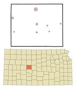
Översiktskarta | |
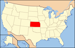
Kansas läge i USA | |
| Redigera Wikidata | |
Liebenthal är en ort i Rush County i Kansas.[5] Vid 2010 års folkräkning hade Liebenthal 103 invånare.[6]
Källor
- ^ läs online, www.cityofliebenthal.net , läst: 8 februari 2024.[källa från Wikidata]
- ^ United States Census Bureau, 2016 U.S. Gazetteer Files, United States Census Bureau, 2016.[källa från Wikidata]
- ^ United States Census Bureau, 2010 U.S. Gazetteer Files, United States Census Bureau, 2010, läst: 9 juli 2020.[källa från Wikidata]
- ^ United States Census Bureau (red.), USA:s folkräkning 2020, läs online, läst: 1 januari 2022.[källa från Wikidata]
- ^ Liebenthal, KS. Map Quest. Läst 24 december 2019.
- ^ 2010 Census Population of Liebenthal, Kansas Arkiverad 24 december 2019 hämtat från the Wayback Machine.. Census Viewer. Läst 24 december 2019.
Media som används på denna webbplats
Författare/Upphovsman: This version: uploader
Base versions this one is derived from: originally created by en:User:Wapcaplet, Licens: CC BY 2.0
Map of USA with Kansas highlighted
Författare/Upphovsman: Arkyan, Licens: CC BY-SA 3.0
This map shows the incorporated and unincorporated areas in Rush County, Kansas, highlighting Liebenthal in red. It was created with a custom script with US Census Bureau data and modified with Inkscape.


