Liberty, Indiana
| Liberty | |
| town | |
Market Street | |
| Land | |
|---|---|
| Delstat | Indiana |
| County | Union County |
| Höjdläge | 300 m ö.h. |
| Koordinater | 39°38′9″N 84°55′44″V / 39.63583°N 84.92889°V |
| Yta | 2,2 km² (2010) |
| - land | 2,2 km² |
| - vatten | 0,0 km² |
| Folkmängd | 2 133 (2010) |
| Befolkningstäthet | 970 invånare/km² |
| Tidszon | EST (UTC-5) |
| - sommartid | CDT (UTC-4) |
| ZIP-kod | 47353 |
| FIPS | 1843434 |
| Geonames | 4260329 |
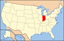
Ortens läge i Indiana | |
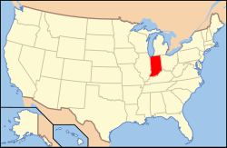
Indianas läge i USA | |
Liberty är administrativ huvudort i Union County i den amerikanska delstaten Indiana.[1] Countyt grundades år 1821 med Brownsville som huvudort. Beslutet om grundandet av en ny huvudort fattades den 21 december 1822 och flytten av huvudort verkställdes år 1823.[2]
Kända personer från Liberty
- Ambrose Burnside, militär och politiker
Källor
- ^ Profile for Liberty, Indiana Arkiverad 10 juni 2016 hämtat från the Wayback Machine.. ePodunk. Läst 2 maj 2016.
- ^ A Few Facts about Union County Arkiverad 2 maj 2016 hämtat från the Wayback Machine.. Union County Public Library. Läst 2 maj 2016.
Media som används på denna webbplats
Shiny red button/marker widget. Used to mark the location of something such as a tourist attraction.
Författare/Upphovsman: This version: uploader
Base versions this one is derived from: originally created by en:User:Wapcaplet, Licens: CC BY 2.0
Map of USA with Indiana highlighted
Författare/Upphovsman: Alexrk2, Licens: CC BY 3.0
Den här Det karta skapades med GeoTools.
Buildings on the eastern side of the junction of Market and Union Streets in Liberty, Indiana, United States. From farthest to closest, they are as follows:
- 1 E. Union Street: Unnamed, Italianate, built 1875
- 1 S. Market Street: J.C. Rose & Son Groceries, Italianate, built 1870
- 3 S. Market Street: Unnamed, no particular style, built 1900
- 15 S. Market Street: J.P. Kennedy/S.W. Creed Building, Romanesque Revival, built 1885


