Lexington, Missouri
| Lexington | |
| city | |
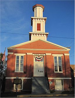
Lexington Museum | |
| Land | |
|---|---|
| Delstat | Missouri |
| County | Lafayette County |
| Höjdläge | 259 m ö.h. |
| Koordinater | 39°10′59″N 93°52′30″V / 39.18306°N 93.87500°V |
| Yta | 13,9 km² (2010) |
| - land | 13,3 km² |
| - vatten | 0,6 km² |
| Folkmängd | 4 726 (2010) |
| Befolkningstäthet | 355 invånare/km² |
| Tidszon | CST (UTC-6) |
| - sommartid | CDT (UTC-5) |
| ZIP-kod | 64067 |
| FIPS | 2941870 |
| Geonames | 4395035 |
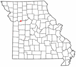
Ortens läge i Missouri | |
Missouris läge i USA | |
| Webbplats: http://www.lexingtonmo.com/ | |
Lexington är administrativ huvudort i Lafayette County i Missouri.[1] Orten fick sitt namn efter Lexington i Kentucky.[2][3]
Kända personer från Lexington
- Josh Hawley, politiker
- Ike Skelton, politiker
- Hugh Campbell Wallace, diplomat
Källor
- ^ Missouri County Map with County Seat Cities. Geology.com Geoscience News and Information. Läst 4 maj 2016.
- ^ Profile for Lexington, Missouri Arkiverad 19 september 2015 hämtat från the Wayback Machine.. ePodunk. Läst 4 maj 2016.
- ^ A Look Back at Historic Lexington Arkiverad 21 mars 2016 hämtat från the Wayback Machine.. Lexington, Missouri. Läst 4 maj 2016.
Externa länkar
|
Media som används på denna webbplats
Författare/Upphovsman: Doug Coldwell, Licens: CC BY 2.0
Lexington Historical Museum in Lexington, Missouri
|
This is an image of a place or building that is listed on the National Register of Historic Places in the United States of America. Its reference number is 78001665. |
Författare/Upphovsman: The original uploader was Catbar på engelska Wikipedia., Licens: CC BY-SA 3.0
Adapted from Wikipedia's MO county maps by Catbar.
Författare/Upphovsman: This version: uploader
Base versions this one is derived from: originally created by en:User:Wapcaplet, Licens: CC BY 2.0
Map of USA with Missouri highlighted


