Lewes, Delaware
| Lewes | |
| city | |
Zwaanendael Museum | |
| Land | |
|---|---|
| Delstat | Delaware |
| County | Sussex County |
| Höjdläge | 4 m ö.h. |
| Koordinater | 38°46′33″N 75°8′32″V / 38.77583°N 75.14222°V |
| Yta | 11 km² (2010) |
| - land | 10 km² |
| - vatten | 1 km² |
| Folkmängd | 2 747 (2010) |
| Befolkningstäthet | 275 invånare/km² |
| Tidszon | EST (UTC-5) |
| - sommartid | EDT (UTC-4) |
| ZIP-kod | 19958 |
| FIPS | 1041830 |
| Geonames | 4143354 |
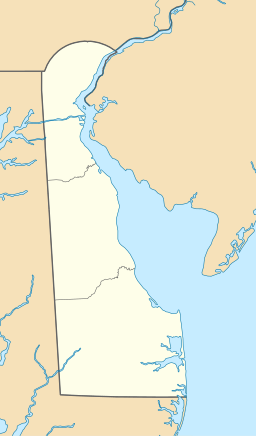
Ortens läge i Delaware | |
Delawares läge i USA | |
| Webbplats: http://www.lewes.com/ | |
Lewes [ˈluːɨs] är en stad i Sussex County i Delaware. Orten fick sitt namn efter Lewes i England.[1] Zwaanendael i Nya Nederländerna, den första europeiska kolonin i Delaware, grundades 1631 där Lewes i dag ligger. Det historiska museet i Lewes har uppkallats efter kolonin.[2] Ortens motto är "The First Town in the First State".[3]
Kända personer från Lewes
- David Hall, politiker
- Joshua Hall, politiker
- Joseph Maull, politiker
- Caleb Rodney, politiker
- Daniel Rodney, politiker
Externa länkar
Källor
- ^ Profile for Lewes, Delaware Arkiverad 9 februari 2013 hämtat från the Wayback Machine.. ePodunk. Läst 17 maj 2016.
- ^ Zwaanendael Museum Arkiverad 24 november 2010 hämtat från the Wayback Machine.. State of Delaware. Läst 17 maj 2016.
- ^ The First Town in the First State. Lewes Chamber of Commerce. Läst 17 maj 2016.
|
Media som används på denna webbplats
Shiny red button/marker widget. Used to mark the location of something such as a tourist attraction.
Författare/Upphovsman: Huebi, Licens: CC BY 2.0
Map of USA with Delaware highlighted
Författare/Upphovsman: Alexrk2, Licens: CC BY 3.0
Den här Det karta skapades med GeoTools.
Taken July 21, 2010


