Lebanon, Ohio
| Lebanon | |
| Stad (city) | |
| Land | |
|---|---|
| Delstat | |
| County | Warren County |
| Höjdläge | 234 m ö.h. |
| Koordinater | 39°25′36″N 84°12′45″V / 39.42667°N 84.21250°V |
| Area | 33,6 km² (2010)[2] |
| Folkmängd | 20 841 (2020)[3] |
| Befolkningstäthet | 620 invånare/km² |
| Grundad | 1802[1] |
| Tidszon | EST (UTC-5) |
| - sommartid | EDT (UTC-4) |
| ZIP-kod | 45036 |
| Riktnummer | 513 |
| GNIS-kod | 1042462 |
| Geonames | 4516412 |
Översiktskarta | |
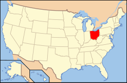
Ohios läge i USA | |
| Wikimedia Commons: Lebanon, Ohio | |
| Webbplats: http://www.lebanonohio.gov/ | |
| Redigera Wikidata | |
Lebanon är en stad i den amerikanska delstaten Ohio med en yta av 30,5 km² och en folkmängd, som uppgår till 19 962 invånare (2000). Lebanon är huvudorten i Warren County, Ohio.
Referenser
- ^ härlett från: Kategori:Orter grundade 1802, läst: 14 november 2018.[källa från Wikidata]
- ^ United States Census Bureau, 2010 U.S. Gazetteer Files, United States Census Bureau, 2010, läst: 9 juli 2020.[källa från Wikidata]
- ^ United States Census Bureau (red.), USA:s folkräkning 2020, läs online, läst: 1 januari 2022.[källa från Wikidata]
Externa länkar
 Wikimedia Commons har media som rör Lebanon, Ohio.
- Officiell webbplats
Media som används på denna webbplats
Författare/Upphovsman: This version: uploader
Base versions this one is derived from: originally created by en:User:Wapcaplet, Licens: CC BY 2.0
Map of USA with Ohio highlighted
Författare/Upphovsman: Catbar på engelska Wikipedia, Licens: CC BY-SA 3.0
Map of Lebanon.
Författare/Upphovsman: R.P. Piper "chain@zinzi.us", Licens: CC BY-SA 3.0
This is "The Golden Lamb" in Lebanon,Ohio. It's taken from almost exactly the same spot as the 1936 photo on the current Wikipedia page pertaining to "The Golden Lamb". But this image was taken in October 2007. Is meant to be a companion to the old one. Some things never change.


