Le Brassus
| Le Brassus | |
| Ort | |
Katolska kyrkan i Le Brassus | |
| Land | |
|---|---|
| Kanton | Vaud |
| Distrikt | Jura-Nord vaudois |
| Kommun | Le Chenit |
| Höjdläge | 1 026 m ö.h. |
| Koordinater | 46°34′58″N 6°12′46″Ö / 46.58278°N 6.21278°Ö |
| Folkmängd | 1 403 (1982)[1] |
| Tidszon | CET (UTC+1) |
| - sommartid | CEST (UTC+2) |
| Postnummer | 1348 |
| Geonames | 2659981 |
| Språk | Franska |
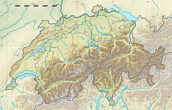
Le Brassus läge i Schweiz | |
Le Brassus är en ort och autonom kommundel i kommunen Le Chenit i kantonen Vaud, Schweiz. Den ligger i dalen Vallée de Joux.
Sport och fritid
I Le Brassus arrangerades Europamästerskapen i orientering 1964.[2]
Källor
- ^ Le Brassus på tyska, franska och italienska i webbaserade Schweiz historielexikon.
- ^ "European Orienteering Championship senior, statistics 1962-1964, 2000-" Arkiverad 23 augusti 2011 hämtat från the Wayback Machine. (läst 3 mars 2008)
|
Media som används på denna webbplats
Författare/Upphovsman: Eric Gaba (Sting - fr:Sting) and NordNordWest, Licens: CC BY-SA 3.0
Blank physical map of Switzerland, for geo-location purpose. More maps: → Maps of Switzerland.
Shiny red button/marker widget. Used to mark the location of something such as a tourist attraction.
Författare/Upphovsman: ItsMariano, Licens: CC BY-SA 4.0
L'église catholique du Brassus, construite à la fin du XIXe siècle.


