Lawrence, Indiana
| Lawrence | |
| city | |
| Land | |
|---|---|
| Delstat | Indiana |
| County | Marion County |
| Höjdläge | 266 m ö.h. |
| Koordinater | 39°51′57″N 85°59′22″V / 39.86583°N 85.98944°V |
| Yta | 52,4 km² (2010)[1] |
| - land | 52,1 km² |
| - vatten | 0,3 km² |
| Folkmängd | 46 001 (2010)[2] |
| Befolkningstäthet | 883 invånare/km² |
| Tidszon | EST (UTC-5) |
| - sommartid | EDT (UTC-4) |
| ZIP-kod | 46216, 46226, 46235–46236, 46256[3] |
| FIPS | 1842426 |
| Geonames | 4260210 |
Ortens läge i Indiana | |
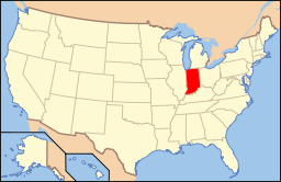
Indianas läge i USA | |
Lawrence är en stad i Marion County i delstaten Indiana, USA med 38 915 invånare (2000).
Källor
- ^ ”2010 Census Gazetteer Files”. US Census Bureau. Arkiverad från originalet den 14 juli 2012. https://www.webcitation.org/699nOulzi?url=http://www.census.gov/geo/www/gazetteer/files/Gaz_places_national.txt. Läst 14 juli 2012.
- ^ ”Lawrence (city), Indiana” (på engelska). State & County Quickfacts. U.S. Census Bureau,. Arkiverad från originalet den 4 augusti 2012. https://www.webcitation.org/69fAv8GaL?url=http://quickfacts.census.gov/qfd/states/18/1842426.html. Läst 4 augusti 2012.
- ^ ”2010 ZIP Code Tabulation Area (ZCTA) Relationship Files”. U.S. Census Bureau. 5 september 2010. Arkiverad från originalet den 25 augusti 2012. https://www.webcitation.org/6ABdwXxbq?url=http://www.census.gov/geo/www/2010census/zcta_rel/zcta_place_rel_10.txt. Läst 25 augusti 2012.
Media som används på denna webbplats
Shiny red button/marker widget. Used to mark the location of something such as a tourist attraction.
Författare/Upphovsman: This version: uploader
Base versions this one is derived from: originally created by en:User:Wapcaplet, Licens: CC BY 2.0
Map of USA with Indiana highlighted
Författare/Upphovsman: Arkyan, Licens: CC-BY-SA-3.0
This map shows the incorporated and unincorporated areas in Marion County, Indiana.
- Highlighting the City of Lawrence in red.
Författare/Upphovsman: Alexrk2, Licens: CC BY 3.0
Den här Det karta skapades med GeoTools.


