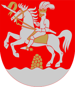
Lapaluoto
| Lapaluoto | |
| Lapaluoto (finska) | |
| Stadsdel fd tätort | |
Pursimiehenkatu i Lapaluoto. | |
| Land | |
|---|---|
| Landskap | Norra Österbotten |
| Kommun | Brahestad |
| Koordinater | 64°40′5″N 24°25′13″Ö / 64.66806°N 24.42028°Ö |
| Area | 1,1 km²[1] |
| Folkmängd | 271 (1980-12-31)[1] |
| Befolkningstäthet | 246 invånare/km² |
| Tidszon | EET (UTC+2) |
| - sommartid | EEST (UTC+3) |
| Tätortskod | 0945 |
Lapaluotos läge i Norra Österbotten | |
Landskapets läge i Finland | |
Lapaluoto är en stadsdel och före detta tätort i Brahestads stad (kommun) i landskapet Norra Österbotten i Finland. Tätorten uppgick i Brahestads centraltätort 1985. I Lapaluoto ligger Brahestads hamn (finska: Raahen satama),[2] och strax söder om stadsdelen ligger SSABs stålverk.[3]
Befolkningsutveckling
| Befolkningsutvecklingen i Lapaluoto 1960–1980[4][1] | ||||
|---|---|---|---|---|
| År | Folkmängd | Landareal (km²) | ||
| 1960 | 390 | 0,65 | ||
| 1970 | 400 | 0,65 | ||
| 1980 | 271 | 1,1 | ||
| Anm.: 1985 sammanvuxen med Brahestads centraltätort. | ||||
Referenser
- ^ [a b c] (på finska och svenska) (
 PDF) Tätorter. Folk- och bostadsräkningen 1980. "Del XIII". Helsingfors: Statistikcentralen. 1983. sid. 74 (71 i pdf:en). ISBN 951-46-6863-4. http://www.doria.fi/bitstream/handle/10024/102429/xvael_c_198000_1983_dig_13.pdf?sequence=1. Läst 20 april 2023
 - ^ ”The history of the Port of Raahe”. Raahen satama. Arkiverad från originalet den 20 april 2023. https://web.archive.org/web/20230420151702/https://www.raahensatama.fi/en/info/history. Läst 20 april 2023.
- ^ ”Paikkatietoikkuna - Geodataportalen”. Lantmäteriverket. https://kartta.paikkatietoikkuna.fi/. Läst 14 april 2023.
- ^ (på engelska, finska och svenska) (
 PDF) Tätorter 1960-1970. Folkräkningen 1970. "Del IV". Helsingfors: Statistikcentralen. 1976. sid. 77 (79 i pdf:en). ISBN 951-46-6863-4. http://www.doria.fi/bitstream/handle/10024/96453/xvael_c_197000_1976_dig_4.pdf?sequence=1. Läst 20 april 2023
| ||||||||||||||||||||||||||
Media som används på denna webbplats
Shiny red button/marker widget. Used to mark the location of something such as a tourist attraction.
Författare/Upphovsman: Fenn-O-maniC, Licens: CC BY-SA 3.0
Location of North Ostrobothnia in Finland.
Författare/Upphovsman: Josutus, Licens: CC BY-SA 3.0
Map of Northern Ostrobothnia Region, Finland. Bounding box 22.7789 63.4291, 30.1384 66.4858
Författare/Upphovsman: Estormiz, Licens: CC0
The Pursimiehenkatu street in the Lapaluoto neighbourhood of Raahe.


