La Palma (olika betydelser)
La Palma kan syfta på:
- La Palma − ö bland Kanarieöarna, tillhör Spanien
- 2912 Lapalma − asteroid i huvudbältet
- La Palma (TV-serie) − norsk dramaserie från 2024
Geografi
Colombia
La Palma i Colombia. |
- La Palma (kommun), Cundinamarca, 5°19′02″N 74°25′48″V / 5.31732°N 74.43003°V
- Hacarí (ort), Norte de Santander, 8°19′24″N 73°08′56″V / 8.32333°N 73.14889°V
Mexiko
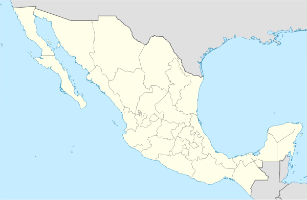
 1 2 3 4 5 6 7 8 9 10 11 12 13 14 15 16 17 18 19 20 21 22 23 24 25 26 27 28 29 30 31 32 33 34 35 36 37 38 39 40 41 42 43 44 45 46 47 48 49 50 51 52 53 54 55 56 57 La Palma i Mexiko. |
- Tamasopo (ort), San Luis Potosí, 21°55′27″N 99°23′37″V / 21.92426°N 99.39365°V
- La Palma, Nopala de Villagrán, 20°11′20″N 99°39′29″V / 20.18899°N 99.65819°V
- La Palma, Colipa, 19°53′11″N 96°41′54″V / 19.88639°N 96.69833°V
- La Palma, Tenosique, 17°26′37″N 91°08′08″V / 17.44366°N 91.1355°V
- La Palma, Pinotepa de Don Luis, 16°23′35″N 97°56′05″V / 16.39299°N 97.93471°V
- Las Palmas, San Jerónimo Coatlán, 16°08′22″N 97°02′58″V / 16.13944°N 97.04944°V
- San Francisco de la Palmita, ort, Durango, Guadalupe Victoria, 24°35′26″N 104°03′44″V / 24.59049°N 104.06227°V
- La Palma, Culiacán, 24°34′55″N 107°12′45″V / 24.58192°N 107.21253°V
- La Palma, Pedro Escobedo, 20°31′20″N 100°10′26″V / 20.52219°N 100.17392°V
- La Palma, Cuerámaro, 20°39′01″N 101°40′48″V / 20.65028°N 101.68°V
- La Palma, Salamanca, 20°29′16″N 101°14′23″V / 20.48764°N 101.23959°V
- La Palma, Luvianos, 19°03′14″N 100°20′50″V / 19.05389°N 100.34722°V
- La Palma, Pánuco, 22°10′03″N 98°09′57″V / 22.1675°N 98.16583°V
- La Palma, Coyutla, 20°24′38″N 97°45′09″V / 20.41056°N 97.7525°V
- La Palma, Empalme, 28°03′01″N 110°42′04″V / 28.05028°N 110.70111°V
- La Palma, Tarímbaro, 19°46′16″N 101°08′27″V / 19.77111°N 101.14083°V
- La Palma, Tezontepec de Aldama, 20°12′59″N 99°15′20″V / 20.21639°N 99.25556°V
- La Palma, San Miguel de Allende, 21°01′28″N 100°46′47″V / 21.02444°N 100.77972°V
- La Palma, Acambay de Ruíz Castañeda, 20°00′41″N 99°54′38″V / 20.01139°N 99.91056°V
- La Palma, Ayotlán, 20°34′12″N 102°25′22″V / 20.57°N 102.42278°V
- La Palma, Querétaro, 20°53′08″N 100°23′26″V / 20.88556°N 100.39056°V
- La Palma, Córdoba, 18°56′28″N 96°59′03″V / 18.94111°N 96.98417°V
- La Palma, Xiutetelco, 19°44′16″N 97°19′43″V / 19.73778°N 97.32861°V
- La Palma, Lagos de Moreno, 21°23′16″N 101°55′18″V / 21.38778°N 101.92167°V
- La Palma, Tepehuacán de Guerrero, 21°05′15″N 98°54′50″V / 21.0875°N 98.91389°V
- La Palma, Silao de la Victoria, 20°53′55″N 101°26′34″V / 20.89861°N 101.44278°V
- La Palma, Tamasopo, 21°47′10″N 99°28′04″V / 21.78611°N 99.46778°V
- La Palma, El Oro, 19°47′39″N 99°59′17″V / 19.79417°N 99.98806°V
- La Palma, Hueyapan de Ocampo, 18°06′56″N 95°13′46″V / 18.11556°N 95.22944°V
- La Palma, Guanajuato kommun, 21°05′16″N 101°21′40″V / 21.08778°N 101.36111°V
- La Palma, Huasca de Ocampo, 20°11′52″N 98°34′43″V / 20.19778°N 98.57861°V
- La Palma, Mineral del Chico, 20°13′12″N 98°41′06″V / 20.22°N 98.685°V
- La Palma, Acuitzio, 19°30′28″N 101°19′10″V / 19.50778°N 101.31944°V
- La Palma, Ixmiquilpan, 20°33′32″N 99°13′50″V / 20.55889°N 99.23056°V
- La Palma, Chilón, 17°03′51″N 91°53′32″V / 17.06417°N 91.89222°V
- La Palma, Chietla, 18°28′28″N 98°36′10″V / 18.47444°N 98.60269°V
- La Palma, Ixtlán de Juárez, 17°36′39″N 96°11′03″V / 17.61083°N 96.18417°V
- La Palma, Naolinco, 19°34′58″N 96°46′11″V / 19.58278°N 96.76972°V
- La Palma, San Pedro Atoyac, 16°30′08″N 97°57′10″V / 16.50222°N 97.95278°V
- La Palma, Valle de Bravo, 19°09′58″N 100°03′12″V / 19.16612°N 100.05332°V
- La Palma, Hueytlalpan, 20°03′55″N 97°38′46″V / 20.06539°N 97.64608°V
- La Palma, Zongolica, 18°37′30″N 96°54′45″V / 18.625°N 96.9125°V
- La Palma, Cuitzeo, 19°55′26″N 101°08′25″V / 19.92389°N 101.14028°V
- La Palma, Pueblo Nuevo, 23°25′55″N 105°39′44″V / 23.43181°N 105.66228°V
- La Palma, Ayutla de los Libres, 16°53′36″N 98°57′59″V / 16.89343°N 98.96651°V
- La Palma, Chinameca, 18°02′42″N 94°42′49″V / 18.045°N 94.71361°V
- La Palma, San Sebastián Tlacotepec, 18°26′00″N 96°49′32″V / 18.43347°N 96.82568°V
- La Palma, Zapotlanejo, 20°37′06″N 103°02′20″V / 20.61833°N 103.03889°V
- La Palma, Chiautla, 18°19′28″N 98°38′46″V / 18.3244°N 98.64622°V
- La Palma, Encarnación de Díaz, 21°34′08″N 102°00′07″V / 21.56889°N 102.00194°V
- La Palma, Tlatlauquitepec, 20°01′44″N 97°24′58″V / 20.02889°N 97.41599°V
- La Palma, Hidalgo kommun, 19°34′33″N 100°48′41″V / 19.57583°N 100.81139°V
- La Palma, Susupuato, 19°17′45″N 100°20′23″V / 19.29583°N 100.33972°V
- La Palma, San Sebastián del Oeste, 20°51′18″N 104°38′13″V / 20.855°N 104.63694°V
- La Palma, Cotaxtla, 18°50′57″N 96°23′37″V / 18.84917°N 96.39361°V
- La Palma, San Salvador, 20°17′26″N 99°01′40″V / 20.29068°N 99.02779°V
- La Palma, Tlapacoya, 20°07′33″N 97°51′03″V / 20.1258°N 97.85081°V
- La Palma, Badiraguato, 25°42′20″N 107°09′16″V / 25.70556°N 107.15444°V
Spanien
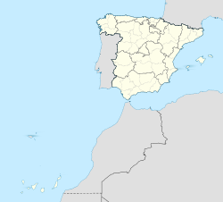
La Palma i Spanien. |
- La Palma del Condado, ort, Andalusien, Provincia de Huelva, 37°23′10″N 6°33′08″V / 37.38605°N 6.55231°V
- La Palma, ö, Kanarieöarna, Provincia de Santa Cruz de Tenerife, 28°40′00″N 17°52′00″V / 28.66667°N 17.86667°V
USA
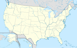
La Palma i USA. |
- La Palma, Kalifornien, ort, Orange County, 33°50′47″N 118°02′48″V / 33.8464°N 118.04673°V
Se även
- Municipio de La Palma – flera
Media som används på denna webbplats
Shiny blue button/marker widget.
Författare/Upphovsman: Sémhur, Licens: CC BY-SA 4.0
Map of Mexico, with states borders.
Författare/Upphovsman: TUBS
Location map of the USA (Hawaii and Alaska shown in sidemaps).
Main map: EquiDistantConicProjection : Central parallel :
* N: 37.0° N
Central meridian :
* E: 96.0° W
Standard parallels:
* 1: 32.0° N
* 2: 42.0° N
Made with Natural Earth. Free vector and raster map data @ naturalearthdata.com.
Formulas for x and y:
x = 50.0 + 124.03149777329222 * ((1.9694462586094064-({{{2}}}* pi / 180))
      * sin(0.6010514667026994 * ({{{3}}} + 96) * pi / 180))
y = 50.0 + 1.6155950752393982 * 124.03149777329222 * 0.02613325650382181
      - 1.6155950752393982  * 124.03149777329222 *
     (1.3236744353715044  - (1.9694462586094064-({{{2}}}* pi / 180))
      * cos(0.6010514667026994 * ({{{3}}} + 96) * pi / 180))
Hawaii side map: Equirectangular projection, N/S stretching 107 %. Geographic limits of the map:
- N: 22.4° N
- S: 18.7° N
- W: 160.7° W
- E: 154.6° W
Alaska side map: Equirectangular projection, N/S stretching 210.0 %. Geographic limits of the map:
- N: 72.0° N
- S: 51.0° N
- W: 172.0° E
- E: 129.0° W
Logo for disambiguation pages.
(c) Miguillen, CC BY-SA 3.0
Location map of Spain with the Canary Islands


