La Dalia
| La Dalia | |
| Ort | |
| Land | |
|---|---|
| Departement | Matagalpa |
| Kommun | El Tuma - La Dalia |
| Koordinater | 13°08′14″N 85°44′10″V / 13.137118°N 85.736010°V |
| Folkmängd | 5 925 (2005) |
| Tidszon | CST (UTC-6) |
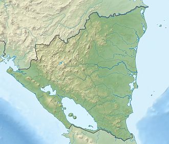
La Dalia, med 5 925 invånare (2005), är centralorten i kommunen El Tuma - La Dalia i departementet Matagalpa, Nicaragua. Den ligger i den bergiga centrala delen av landet, 43 kilometer nordost om Matagalpa.[1][2]
Källor
- ^ Instituto Nacional de Información de Desarrollo, Censo 2005. Arkiverad 19 augusti 2016 hämtat från the Wayback Machine.
- ^ ”Zonu.com, Mapas Departamentos de Nicaragua”. Arkiverad från originalet den 26 november 2016. https://web.archive.org/web/20161126115038/http://www.zonu.com/mapas_nicaragua/Mapas_Mapa_Satelital_Foto_Imagen_Satelite_Nicaragua_2.htm#departamentos. Läst 15 januari 2017.
Media som används på denna webbplats
Författare/Upphovsman: Alexrk2, Licens: CC BY-SA 3.0
Physical Location map Nicaragua with Departamentos, Equirectangular projection, N/S stretching 100 %. Geographic limits of the map:
Shiny red button/marker widget. Used to mark the location of something such as a tourist attraction.


