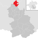
Kremsmünster
| Kremsmünster | ||
| Kommun | ||
| Land | ||
|---|---|---|
| Förbundsland | Oberösterreich | |
| Distrikt | Kirchdorf | |
| Koordinater | 48°03′10″N 14°07′43″Ö / 48.0529°N 14.1286°Ö | |
| Area | 42,13 km²[1] | |
| Folkmängd | 7 060 (1 januari 2024)[2] | |
| Befolkningstäthet | 168 invånare/km² | |
| Tidszon | CET (UTC+1) | |
| - sommartid | CEST (UTC+2) | |
| Kommunkod | 40907 | |
| Geonames | 7871034 | |
Kremsmünster är en ort och köpingskommun i Österrike. Den ligger i distriktet Kirchdorf i förbundslandet Oberösterreich, 170 km väster om huvudstaden Wien. Orten är känd för klostret Kremsmünster, ett benediktinerkloster med anor från 700-talet.
Källor
- ^ ”Gemeindeverzeichnis 2024” (på tyska) (.ods). Statistik Austria. https://www.statistik.at/fileadmin/pages/453/RegGemVz2024.ods. Läst 20 augusti 2024.
- ^ ”Bevölkerung zu Jahresbeginn nach administrativen Gebietseinheiten (Bundesländer, NUTS-Regionen, Bezirke, Gemeinden) seit 2002” (på tyska) (.ods). Statistik Austria. https://www.statistik.at/fileadmin/pages/405/Bev_Zeitreihe_Jahresbeginn_Gebietseinheiten_2024.ods. Läst 20 augusti 2024.
Externa länkar
 Wikimedia Commons har media som rör Kremsmünster.
Media som används på denna webbplats
Författare/Upphovsman: Uwe Dedering, Licens: CC BY-SA 3.0
Location map of Austria
Equirectangular projection, N/S stretching 150 %. Geographic limits of the map:
- N: 49.2° N
- S: 46.3° N
- W: 9.4° E
- E: 17.2° E
Shiny red button/marker widget. Used to mark the location of something such as a tourist attraction.
Författare/Upphovsman: Isiwal, Licens: CC BY-SA 4.0
Kremsmünster abbey was founded in 777. The buildings as visible were erected in the 17th and 18th century. The tower at the left is an observatory where meteorological date are recorded since 1763. The secondary school imparts general education and humanistic-catholic attitude.
Författare/Upphovsman: Joschi Täubler, Licens: CC BY-SA 3.0
district Kirchdorf an der Krems


