Kosciusko County
| Kosciusko County | |
| County | |
Kosciusko Countys domstolshus i Warsaw. | |
| Land | |
|---|---|
| Delstat | |
| Huvudort | Warsaw |
| Största stad | Warsaw |
| Area | 1 436 km² (2010)[1] |
| - land | 1 376 km² (96%) |
| - vatten | 59,6 km² (4%) |
| Folkmängd | 77 358 (2010)[2] |
| Befolkningstäthet | 56 invånare/km² |
| Grundat | 1836 |
| - uppkallat efter | Tadeusz Kościuszko |
| Tidszon | EST (UTC-5) |
| - sommartid | EDT (UTC-4) |
| FIPS-kod | 18085 |
| Geonames | 4922408 |
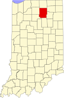
Läge i delstaten Indiana. | |
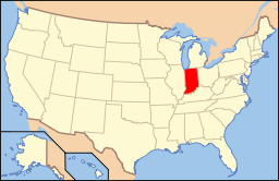
Delstatens läge i USA. | |
| Webbplats: https://www.kcgov.com/ | |
Kosciusko County är ett administrativt område i delstaten Indiana, USA. År 2010 hade countyt 77 358 invånare. Den administrativa huvudorten (county seat) är Warsaw.
Geografi
Enligt United States Census Bureau har countyt en total area på 1 436 km². 1 392 km² av den arean är land och 44 km² är vatten.
Angränsande countyn
- Elkhart County - nord
- Noble County - nordost
- Whitley County - sydost
- Wabash County - syd
- Fulton County - sydväst
- Marshall County - väst
Orter
- Burket
- Claypool
- Etna Green
- Leesburg
- Mentone
- Milford
- Nappanee (delvis i Elkhart County)
- North Webster
- Pierceton
- Sidney
- Silver Lake
- Syracuse
- Warsaw (huvudort)
- Winona Lake
Källor
- ^ ”2010 Census U.S. Gazetteer Files for Counties”. U.S. Census Bureau. Arkiverad från originalet den 5 juli 2012. https://www.webcitation.org/68vYLbou5?url=http://www.census.gov/geo/www/gazetteer/files/Gaz_counties_national.txt. Läst 5 juli 2012.
- ^ ”State & County QuickFacts, Kosciusko County, Indiana” (på engelska). U.S. Census Bureau. Arkiverad från originalet den 13 juli 2011. https://www.webcitation.org/608ltz3dL?url=http://quickfacts.census.gov/qfd/states/18/18085.html. Läst 6 juli 2011.
|
Media som används på denna webbplats
Författare/Upphovsman: This version: uploader
Base versions this one is derived from: originally created by en:User:Wapcaplet, Licens: CC BY 2.0
Map of USA with Indiana highlighted
Front and eastern side of the Old Kosciusko County Courthouse, located at 613 E. Fort Wayne Street in Warsaw, Indiana, United States. Built in 1881, it is a part of the Warsaw Courthouse Square Historic District, a historic district that is listed on the National Register of Historic Places.
This is a locator map showing Kosciusko County in Indiana. For more information, see Commons:United States county locator maps.


