Korinth (perifereiakí enótita)
| Den här artikeln behöver källhänvisningar för att kunna verifieras. (2022-01) Åtgärda genom att lägga till pålitliga källor (gärna som fotnoter). Uppgifter utan källhänvisning kan ifrågasättas och tas bort utan att det behöver diskuteras på diskussionssidan. |
| Korinth (Κορινθία) | |
| Korinthia | |
| Perifereiakí enótita | |
Vy över Korintiska kanalen | |
| Land | |
|---|---|
| Region | Peloponnesos |
| Koordinater | 37°55′00″N 22°40′00″Ö / 37.91667°N 22.66667°Ö |
| Huvudstad | Korinth |
| Area | 2 290 km² |
| Folkmängd | 144 527 (2005) |
| Befolkningstäthet | 63 invånare/km² |
| Tidszon | EET (UTC+2) |
| - sommartid | EEST (UTC+3) |
| Postnummer | 20x xx |
| Riktnummer | 274x0 |
| Geonames | 259290 |
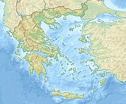
Läge i Grekland | |
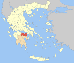
Korinths läge i dagens Grekland | |
Korinth (grekiska Κορινθία, Korinthia) är en regiondel (perifereiakí enótita), till 2010 en prefektur, i nordöstra änden av halvön Peloponnesos. Den hänger samman med övriga Grekland vid Korintiska näset, som genomskärs av Korintiska kanalen. Regiondelen har en yta på 2 290 m² och ett invånarantal på 144 527 (2005). Dess huvudstad är Korinth.
Regiondelen är indelad i sex kommuner . Den tidigare perfekturen var indelad i 15 kommuner.
- Dimos Corinth
- Dimos Loutraki-Agioi Theodoroi
- Dimos Nemea
- Dimos Sikyona
- Dimos Velo-Vocha
- Dimos Xylokastro-Evrostina
| |||||||||||||
Media som används på denna webbplats
Författare/Upphovsman: Tkgd2007, Licens: CC BY-SA 3.0
A new incarnation of Image:Question_book-3.svg, which was uploaded by user AzaToth. This file is available on the English version of Wikipedia under the filename en:Image:Question book-new.svg
Författare/Upphovsman:
- Greece_location_map.svg: Lencer / derivative work: Uwe Dedering (talk)
Location map of Greece
Shiny red button/marker widget. Used to mark the location of something such as a tourist attraction.
Locator map of Korinthia prefecture (Νομός Κορινθίας) in Greece


