Kongsmarken
| Kongsmarken | |
| By | |
Kongsmarken | |
| Land | |
|---|---|
| Landskap | Skåne |
| Län | Skåne län |
| Kommun | Lunds kommun |
| Distrikt | Genarps distrikt |
| Koordinater | 55°36′16″N 13°18′15″Ö / 55.60444°N 13.30417°Ö |
| Tidszon | CET (UTC+1) |
| - sommartid | CEST (UTC+2) |
| Postort | Genarp |
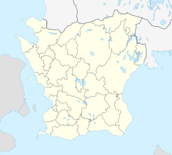
Kongsmarkens läge i Skåne län | |
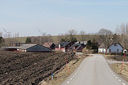
Kongsmarken är en by i Lyngby socken, Lunds kommun.
Kongsmarken var 1894–1948 en järnvägsstation på Malmö–Genarps Järnväg (MGJ). Åren 1902–1938 grävdes lera upp i en lertäkt i Kongsmarken till Klagshamns Cementverk.
Media som används på denna webbplats
Författare/Upphovsman: Erik Frohne, Licens: CC BY 3.0
Location map of Scania (Skåne) in Sweden
Equirectangular projection, N/S stretching 179 %. Geographic limits of the map:
- N: 56° 37' N
- S: 55° 12' N
- W: 12° 12' E
- E: 15° 00' E
Shiny red button/marker widget. Used to mark the location of something such as a tourist attraction.
Författare/Upphovsman: Jsdo1980, Licens: CC BY-SA 3.0
See about CoA blazoning: [Expand]


