Kirkby-in-Ashfield
| Kirkby-in-Ashfield | |
| Stad | |
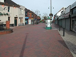
(c) Tom Courtney, CC BY-SA 2.0 Centrala Kirkby-in-Ashfield | |
| Land | |
|---|---|
| Riksdel | England |
| Region | East Midlands |
| Ceremoniellt grevskap | Nottinghamshire |
| Administrativt grevskap | Nottinghamshire |
| Distrikt | Ashfield |
| Koordinater | 53°05′56″N 01°14′42″V / 53.09889°N 1.24500°V |
| Area | 7,03 km²[1] |
| Folkmängd | 26 927 (2011)[1] |
| Befolkningstäthet | 3 830 invånare/km² |
| Tidszon | WET (UTC+0) |
| - sommartid | BST (UTC+1) |
| Postort | NOTTINGHAM |
| Postnummer | NG17 |
| Riktnummer | 01623 |
| Geonames | 2645309 |
Contains Ordnance Survey data © Crown copyright and database right, CC BY-SA 3.0 Kirkby-in-Ashfields läge i Nottinghamshire | |
Kirkby-in-Ashfield är en stad i grevskapet Nottinghamshire i England. Staden är huvudort i distriktet Ashfield och ligger cirka 17 kilometer nordväst om Nottingham samt cirka 6 kilometer sydväst om Mansfield. Tätortsdelen (built-up area sub division) Kirkby-in-Ashfield hade 26 927 invånare vid folkräkningen år 2011.[1] Staden nämndes i Domedagsboken (Domesday Book) år 1086, och kallades då Chirchebi.[2]
Referenser
- ^ [a b c] ”Kirkby-in-Ashfield Built-up area sub division - Local Area Report - Nomis”. www.nomisweb.co.uk. https://www.nomisweb.co.uk/reports/localarea?compare=E35000267. Läst 30 december 2020.
- ^ ”Nottinghamshire F-R”. The Domesday Book Online. http://www.domesdaybook.co.uk/nottinghamshire2.html#kirkbyinashfield. Läst 18 mars 2023.
Externa länkar
 Wikimedia Commons har media som rör Kirkby-in-Ashfield.
Media som används på denna webbplats
Shiny red button/marker widget. Used to mark the location of something such as a tourist attraction.
Contains Ordnance Survey data © Crown copyright and database right, CC BY-SA 3.0
Map of Nottinghamshire, UK with the following information shown:
- Administrative borders
- Coastline, lakes and rivers
- Roads and railways
- Urban areas
Equirectangular map projection on WGS 84 datum, with N/S stretched 165%
Geographic limits:
- West: 1.37W
- East: 0.42W
- North: 53.51N
- South: 52.78N
(c) Tom Courtney, CC BY-SA 2.0
Shopping Area, Kirkby in Ashfield. this is Lowmoor Road looking north, seen from the junction with Diamond Avenue, Station Street and Kingsway. It is the central part of what is strictly East Kirkby, but is the main concentration of shops and services.


