King Island (olika betydelser)
King Island kan syfta på:
Geografi
Antarktis
- King Island, Antarktis, 65°30′52″S 64°01′32″V / 65.51447°S 64.02569°V
Australien
- King Island, ö, Tasmanien, 39°53′S 144°03′Ö / 39.89°S 144.05°Ö
- King Island, Tasmanien, region, Tasmanien, 39°52′20″S 143°59′30″Ö / 39.87215°S 143.99153°Ö
- King Island (ö i Australien, Queensland, lat -14,10, long 144,33), 14°05′44″S 144°20′00″Ö / 14.09552°S 144.33322°Ö
Kanada
- King Island, Newfoundland, ö,47°36′00″N 54°11′53″V / 47.5999°N 54.19815°V
- King Island, Saskatchewan, ö, 53°55′00″N 106°11′04″V / 53.9168°N 106.18431°V
- King Island, British Columbia, ö,52°12′27″N 127°38′26″V / 52.20761°N 127.64053°V
- King Island, Nunavut, ö, 60°36′01″N 64°45′55″V / 60.6002°N 64.76523°V
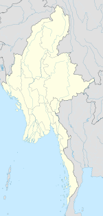
Myanmar
- King Island, Myanmar, ö i Taninthayiregionen, 12°30′36″N 98°22′39″Ö / 12.50995°N 98.37746°Ö
Media som används på denna webbplats
Shiny blue button/marker widget.
Författare/Upphovsman: NordNordWest, Licens: CC BY-SA 3.0
Location map of Australia
Logo for disambiguation pages.
Författare/Upphovsman: Alexrk2, Licens: CC BY-SA 3.0
Location map Antarctica, Azimuthal equidistant projection
Författare/Upphovsman: unknown, Licens:
Författare/Upphovsman: Yug, Licens: CC BY-SA 3.0
cropped version of Carte administrative du Canada.svg for map location.


