Killingworth, Connecticut
| Killingworth | |
| Land | |
|---|---|
| Delstat | |
| County | Lower Connecticut River Valley Planning Region |
| Höjdläge | 119 m ö.h. |
| Koordinater | 41°22′50″N 72°34′35″V / 41.38056°N 72.57639°V |
| Area | 92,72 km² |
| Folkmängd | 6 174 (2020)[2] |
| Befolkningstäthet | 67 invånare/km² |
| Grundad | 1667[1] |
| Tidszon | EST (UTC-5) |
| - sommartid | EDT (UTC-4) |
| ZIP-kod | 06419 |
| Riktnummer | 860 |
| GNIS-kod | 213448 |
| Geonames | 4837289 |
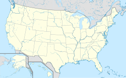
Ortens läge i USA | |
| Wikimedia Commons: Killingworth, Connecticut | |
| Webbplats: http://www.killingworthct.com/ | |
| Redigera Wikidata | |
Killingworth är en kommun (town) i Middlesex County i delstaten Connecticut, USA. Vid folkräkningen år 2000 bodde 6 018 personer på orten. Den har enligt United States Census Bureau en area på totalt 92,7 km² varav 1,2 km² är vatten.
Kända personer från Killingworth
- Washington F. Willcox, politiker
Referenser
- ^ hämtat från: engelskspråkiga Wikipedia.[källa från Wikidata]
- ^ United States Census Bureau (red.), USA:s folkräkning 2020, läs online, läst: 1 januari 2022.[källa från Wikidata]
| ||||||||||
Media som används på denna webbplats
Författare/Upphovsman: TUBS
Location map of the USA (Hawaii and Alaska shown in sidemaps).
Main map: EquiDistantConicProjection : Central parallel :
* N: 37.0° N
Central meridian :
* E: 96.0° W
Standard parallels:
* 1: 32.0° N
* 2: 42.0° N
Made with Natural Earth. Free vector and raster map data @ naturalearthdata.com.
Formulas for x and y:
x = 50.0 + 124.03149777329222 * ((1.9694462586094064-({{{2}}}* pi / 180))
      * sin(0.6010514667026994 * ({{{3}}} + 96) * pi / 180))
y = 50.0 + 1.6155950752393982 * 124.03149777329222 * 0.02613325650382181
      - 1.6155950752393982  * 124.03149777329222 *
     (1.3236744353715044  - (1.9694462586094064-({{{2}}}* pi / 180))
      * cos(0.6010514667026994 * ({{{3}}} + 96) * pi / 180))
Hawaii side map: Equirectangular projection, N/S stretching 107 %. Geographic limits of the map:
- N: 22.4° N
- S: 18.7° N
- W: 160.7° W
- E: 154.6° W
Alaska side map: Equirectangular projection, N/S stretching 210.0 %. Geographic limits of the map:
- N: 72.0° N
- S: 51.0° N
- W: 172.0° E
- E: 129.0° W
Shiny red button/marker widget. Used to mark the location of something such as a tourist attraction.
(c) Polaron at en.wikipedia, CC BY-SA 3.0
Town historical marker for Killingworth, Connecticut


