Kharg (ö)
| Kharg | |
| Jazireh-ye Kharg, Khark, Jazireh-ye Khark | |
| Ö | |
Kharg ö. | |
| Land | |
|---|---|
| Provins | Bushehr |
| Shahrestan | Bushehr |
| Bakhsh | Kharg |
| Koordinater | 29°14′45″N 50°18′57″Ö / 29.24583°N 50.31583°Ö |
| Area | 21,96 km² |
| Tidszon | IRST (UTC+3:30) |
| - sommartid | IRDT (UTC+4:30) |
| Geonames | 127757 |
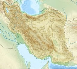
Läge i Iran | |
Kharg (persiska: خارگ, Kharg; جزیره خارگ, Jazireh-ye Kharg), eller Khark (خارک), är en ö nära hamnstaden Ganaveh i provinsen Bushehr i Iran.[1] Denna ö bildades för 14 000 år sedan enligt geologer.[2] Många historiska fynd har hittats på ön.[2] På ön ligger orten Kharg.
Källor
- ^ Jazīreh-ye Khārk hos Geonames.org (cc-by); post uppdaterad 2014-10-07; databasdump nerladdad 2016-08-15
- ^ [a b] ”Island of Khārg or Khārk - Iran Culture” (på engelska). Iran Cultura. https://en.irancultura.it/tourism/attractions/attractions-bushehr/bushehr-the-island-of-Khark/. Läst 7 mars 2019.
Media som används på denna webbplats
Flag of Iran. The tricolor flag was introduced in 1906, but after the Islamic Revolution of 1979 the Arabic words 'Allahu akbar' ('God is great'), written in the Kufic script of the Qur'an and repeated 22 times, were added to the red and green strips where they border the white central strip and in the middle is the emblem of Iran (which is a stylized Persian alphabet of the Arabic word Allah ("God")).
The official ISIRI standard (translation at FotW) gives two slightly different methods of construction for the flag: a compass-and-straightedge construction used for File:Flag of Iran (official).svg, and a "simplified" construction sheet with rational numbers used for this file.
Shiny red button/marker widget. Used to mark the location of something such as a tourist attraction.
Författare/Upphovsman: Uwe Dedering, Licens: CC BY-SA 3.0
Topographic map of the Iranian plateau in Central Asia, connecting to Anatolia in the west and Hindu Kush and Himalaya in the east.
Khark island, Iran (1973)


