Kennedy
Kennedy kan syfta på:
- Kennedys hjärna – roman av Henning Mankell, 2005
- Kennedys sjukdom – ärftlig neuromuskulär sjukdom
- Dead Kennedys – amerikanskt punkband
- G.D. Kennedy – svenskt fullriggat skolskepp, senare känt som af Chapman (1888)
- Mr. Kennedy – artistnamn för wrestlaren Ken Anderson
- The Jamie Kennedy Experiment – amerikansk TV-serie
John F. Kennedy, USA:s president 1961−1963
- John F. Kennedy (1917–1963), biografisk artikel
- Mordet på John F. Kennedy
- Kennedyklanen – hans familj
Personer
- Kennedy (efternamn) – ett efternamn och personer med namnet
- John Kennedy (olika betydelser) – ett namn och personer med namnet
- Kennedy (adelsätt) – en svensk adelsätt
- Kennedy (auktor) – beteckningar vid biologisk namngivning
Personer med förnamnet Kennedy
- Kennedy Bakircioglu (född 1980), svensk fotbollsspelare
- Kennedy Igboananike (född 1989), nigeriansk-svensk fotbollsspelare
- Kennedy Jones (1865–1921), brittisk tidningsman
- Kennedy Katende (född 1985), svensk boxare
- Kennedy McKinney (född 1966), amerikansk boxare
- Kennedy Mweene (född 1984), zambisk fotbollsmålvakt
- Kennedy Ochieng (född 1971), kenyansk kortdistanslöpare
Företeelser uppkallade efter John F. Kennedy
- John F. Kennedy Center for the Performing Arts – kulturcenter, Washington, D. C.
- John F. Kennedy International Airport – New York, New York
- John F. Kennedy School of Government – Harvard University, Cambridge, Massachusetts
- John F. Kennedy Space Center – Cape Canaveral, Florida
- USS John F. Kennedy (CV-67) – ett amerikanskt hangarfartyg i tjänst 1968–2007
- USS John F. Kennedy (CVN-79) – ett framtida hangarfartyg av Gerald R. Ford-klass i amerikanska flottan
- Presidente Kennedy – två kommuner i Brasilien
Företeelser uppkallade efter Jacqueline Kennedy Onassis
- Jacqueline Kennedy Onassis Reservoir – vattensamling, tidigare dricksvattenreservoar i Central Park, New York, USA
- Jacqueline Kennedys trädgård – anläggning vid Vita huset, Washington, District of Columbia, USA
Geografi
Antarktis
- Cape Kennedy, Antarktis, 66°27′S 98°30′Ö / 66.45°S 98.5°Ö
- Mount Kennedy, Antarktis, 67°52′00″S 66°14′00″Ö / 67.86667°S 66.23333°Ö
- Kennedy Glacier
Australien
- North Kennedy River
- Port Kennedy
Kanada
- Kennedy Channel
- Kennedy Island
- Kennedy Lake
USA
- Kennedy, Alabama, ort, Lamar County, 33°35′13″N 87°59′04″V / 33.58706°N 87.98447°V
- Kennedy, Minnesota, ort, Kittson County, 48°38′31″N 96°54′32″V / 48.64193°N 96.90895°V
- Kennedy, New York, ort, Chautauqua County, 42°09′26″N 79°06′07″V / 42.15728°N 79.10199°V
- Kennedy, Kalifornien, ort, San Joaquin County, 37°55′48″N 121°15′10″V / 37.92992°N 121.25272°V
Se även
- Kennedy Peak
- Kennedy Ridge
- Kennedy River
- Mount Kennedy
Media som används på denna webbplats
Författare/Upphovsman: Alexrk2, Licens: CC BY-SA 3.0
Location map Antarctica, Azimuthal equidistant projection
Shiny blue button/marker widget.
Författare/Upphovsman: TUBS
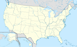
Location map of the USA (Hawaii and Alaska shown in sidemaps).
Main map: EquiDistantConicProjection : Central parallel :
* N: 37.0° N
Central meridian :
* E: 96.0° W
Standard parallels:
* 1: 32.0° N
* 2: 42.0° N
Made with Natural Earth. Free vector and raster map data @ naturalearthdata.com.
Formulas for x and y:
x = 50.0 + 124.03149777329222 * ((1.9694462586094064-({{{2}}}* pi / 180))
      * sin(0.6010514667026994 * ({{{3}}} + 96) * pi / 180))
y = 50.0 + 1.6155950752393982 * 124.03149777329222 * 0.02613325650382181
      - 1.6155950752393982  * 124.03149777329222 *
     (1.3236744353715044  - (1.9694462586094064-({{{2}}}* pi / 180))
      * cos(0.6010514667026994 * ({{{3}}} + 96) * pi / 180))
Hawaii side map: Equirectangular projection, N/S stretching 107 %. Geographic limits of the map:
- N: 22.4° N
- S: 18.7° N
- W: 160.7° W
- E: 154.6° W
Alaska side map: Equirectangular projection, N/S stretching 210.0 %. Geographic limits of the map:
- N: 72.0° N
- S: 51.0° N
- W: 172.0° E
- E: 129.0° W
Logo for disambiguation pages.


