Jugoslaviens upplösning
| Den här artikeln behöver fler eller bättre källhänvisningar för att kunna verifieras. (2013-10) Åtgärda genom att lägga till pålitliga källor (gärna som fotnoter). Uppgifter utan källhänvisning kan ifrågasättas och tas bort utan att det behöver diskuteras på diskussionssidan. |
| |||||

Jugoslaviens upplösning hänvisar till en rad konflikter och politiska omvälvningar som från juni 1991 och framåt resulterade i upplösningen av SFR Jugoslavien.[1]
SFR Jugoslavien var en mångnationell och mångkulturell federation som sträckte sig från Centraleuropa till Balkan – en region med en historia av etniska konflikter. Landet bestod av sex regionala republiker och två autonoma provinser som var fördelade längs ungefärliga etniska linjer och som under 1990-talet splittrades upp i flera självständiga länder. Dessa åtta federala enheter var de sex republikerna: Slovenien, Kroatien, Bosnien och Hercegovina, Makedonien, Montenegro, Serbien och två autonoma provinser inom Serbien: Kosovo och Vojvodina.
Med Bosniens demografiska struktur innefattande en population på nästan 50% serber och kroater och med idéer om självständighet vilande med etniciteterna snarare än hela nationen, blev kontroll av territoriet återigen öppet för tolkning. En tvist mellan Bosnien, Kroatien och Serbien om landsområdets rätta ägare ledde till jugoslaviska krigen.
Serbien och Montenegro kvarstod från april 1992 som delstater i Förbundsrepubliken Jugoslavien, som i februari 2003 upplöstes.[2] I stället bildades Staten Serbien och Montenegro, som upplöstes då Montenegro blev en självständig stat i juni 2006, sedan majoriteten av montenegrinerna vid en folkomröstning i maj samma år sagt ja till självständighet.[3]
Referenser
- ^ ”Yugoslavia” (på engelska). World Statesmen. http://www.worldstatesmen.org/Serbia.html#Yugoslavia. Läst 26 februari 2015.
- ^ Susanna Vidlund (4 februari 2003). ”Jugoslavien upplöst” (på svenska). Aftonbladet. https://www.aftonbladet.se/nyheter/article10340061.ab. Läst 26 april 2018.
- ^ ”Serbien erkänner Montenegro” (på svenska). Svenska dagbladet. https://www.svd.se/serbien-erkanner-montenegro.
Externa länkar
- Video om konflikten i före detta Judoslavien från Dean Peter Krogh Foreign Affairs Digital Archives (engelska)
| |||||||||||||
| ||||||||
Media som används på denna webbplats
Författare/Upphovsman: Tkgd2007, Licens: CC BY-SA 3.0
A new incarnation of Image:Question_book-3.svg, which was uploaded by user AzaToth. This file is available on the English version of Wikipedia under the filename en:Image:Question book-new.svg
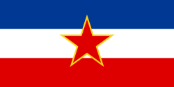
Flag of the Socialist Federal Republic of Yugoslavia (1946-1992).
The design (blazon) is defined in Article 4 of the Constitution for the Republic of Yugoslavia (1946). [1]
Flag of the Socialist Federal Republic of Yugoslavia (1946-1992).
The design (blazon) is defined in Article 4 of the Constitution for the Republic of Yugoslavia (1946). [1]
Flag of Romania (28 March 1948 - 24 September 1952)

Construction sheet of the Flag of Romania as depicted in Decree nr. 972 from 5 November 1968.
- l = 2/3 × L
- C = 1/3 × L
- S = 2/5 × l
Författare/Upphovsman: Hoshie, Licens: CC BY-SA 3.0
This is an animated GIF that shows the stages of the breakup of the SFR Yugoslavia in the 90's and 2000's. The map based off Morwen's map of the divisions of the SFRY, Which is licensed by the GFDL. The source for the dates of independence is the CIA World Factbook. These maps do not now show the Inter-Entity Boundary Line (IEBL) and/or the entities that are separated by it. The IEBL has been drawn based on this CIA map; the Brčko District has been drawn based on Image:BH municipality location.gif, by user:Ante Perkovic. I might add them in the future.
Since the original map was GFDL, this image is as well.
A map depicting Kosovo's final status is ready once it takes effect.
Changelog for versions 2/3:
Here are some changes in this new build of the map:
- The Kosovo boundary has been given a shade of red instead of the previous UN blue since they are a province of Serbia under UNIMIK control.
- Montenegro's color has been changed to a golden shade close to what's on the flag.
- The IEBL and the Brčko District has been redrawn because I deleted the original map; the color for the Republika Srpska is lighter.
- The dates are at the top left hand corner of the map instead of the bottom.
- I have taken a new approach as to the boundaries. Each part of Yugoslavia now shows the boundary on the maps starting the year they broke away. I feel this change helps readers understand the breakup better.
- The SFRY and the FRY are in different shades since the FRY was never accepted as the successor to the former by the UN.
- The colors for the entities of BiH have been removed as to not confuse people into thinking that they are independent states. What remains is the IEBL with both entities in green.
- The Kosovo boundary is finally in hash marks!
- The Brčko District has been removed. The sale is too small to show accurately.
Changelog for version 4:
- The map is larger!
- The image has been rebuilt to include the eastern part of FYR Macedonia.
- The image has been updated to take in Kosovo's new status.
- The IEBL is now a darker line.
- Montenegro, Kosovo, and FRY/SCG/Serbia have new colors!
Changelog for version 5:
- Rebuilt
- Larger map: size of base image
- Accurate Inter-Entity Boundary Line
(c) Lear 21 på engelska Wikipedia, CC BY-SA 3.0
The Fall of the Berlin Wall, 1989. The photo shows a part of a public photo documentation wall at the Brandenburg Gate, Berlin. The photo documentation is permanently placed in the public.
Government Ensign of Hungary, flown by state-owned, non-military vessels from 1957 to 1990.
Författare/Upphovsman: Scroch, Licens: CC BY-SA 4.0
National Flag of the People's Republic of Bulgaria (1948-1968). Tha flag has got the coat-of-arms from 1948


