Jessheim
| Jessheim | |
| Ort | |
| Land | |
|---|---|
| Fylke | Akershus fylke |
| Kommun | Ullensakers kommun |
| Koordinater | 60°8′24″N 11°10′31″Ö / 60.14000°N 11.17528°Ö |
| Area | |
| - tätort | 7,52 km² |
| - kommun | 252,45 km² (2020) |
| Folkmängd | |
| - tätort | 23 918 (2023)[2] |
| - kommun | 42 866 (2023)[1] |
| Befolkningstäthet | |
| - tätort | 3 200 inv./km² |
| - kommun | 170 inv./km² |
| Tidszon | CET (UTC+1) |
| - sommartid | CEST (UTC+2) |
| Postnummer | 2050[3] |
| Tätortskod | 0659 |
| Geonames | 3150851 |
(c) Karte: NordNordWest, Lizenz: Creative Commons by-sa-3.0 de Ortens läge i Akershus fylke | |
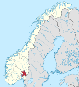
(c) Karte: NordNordWest, Lizenz: Creative Commons by-sa-3.0 de Akershus fylke i Norge | |
| Wikimedia Commons: Jessheim | |
Redigera Wikidata | |
Jessheim är en tätort och stad som utgör centralort i Ullensakers kommun i Akershus fylke i sydöstra Norge. Orten ligger kring Jessheims station på Hovedbanen. Orten har 22 953 invånare (2022). I närheten ligger gravhögen Raknehaugen.
Namnet kommer av fornnordiskans Jasseimr eller Jesseímr. Den första leden är otolkad, medan den andra betyder 'hem'. Ursprungligen användes namnet om Hovins socken, från slutet av 1800-talet också om järnvägsstationen.
Näringsliv
Orten är ett administrativt centrum med viktiga regionala funktioner, bland annat ett betydande handels- och servicecentrum för Øvre Romerike. Här finns industrier, bland annat en cementvarufabrik som utnyttjar de stora sand- och grusförekomsterna i omgivningen, och en trävarufabrik.
I Jessheim finns ett gymnasium och Romerike folkhögskola. Romerikes Blads lokalredaktion ligger på orten.
Kommunikationer
Europaväg 6 går väster om Jessheim, och avståndet till Oslo längs vägen är 41 kilometer, längs järnvägen 45 kilometer. Orten är en viktig vägknutpunkt med fylkesväg 174 västerut till Gardermoen, Nannestad och Hurdal och österut till Kongsvingerveien (riksväg 2).
Bilder
- Gamla kommunhuset i Jessheim.
- Jessheims station.
Källor
- ”Jessheim”. Store norske leksikon. http://snl.no/Jessheim. Läst 24 augusti 2011.
Noter
- ^ 07459: Alders- og kjønnsfordeling i kommuner, fylker og hele landets befolkning (K) 1986 - 2023 (på norskt bokmål), Statistisk sentralbyrå, 21 februari 2023, läs online.[källa från Wikidata]
- ^ läs online, www.citypopulation.de .[källa från Wikidata]
- ^ hämtat från: engelskspråkiga Wikipedia.[källa från Wikidata]
Externa länkar
 Wikimedia Commons har media som rör Jessheim.
| ||||||||||||||||||||||||||||||||||||||||||||||||||||||||||||||||||||||||||||||||||||||||||||||||||||||||||||||||||||||||||||
Media som används på denna webbplats
Författare/Upphovsman: Gutten på Hemsen, Licens: CC0
Flag of Norway with colors from the previous version on Commons. This file is used to discuss the colors of the Norwegian flag.
Shiny red button/marker widget. Used to mark the location of something such as a tourist attraction.
(c) Karte: NordNordWest, Lizenz: Creative Commons by-sa-3.0 de
Location of county Akershus in Norway (2024)
Jessheim Railway station, Ullensaker, Norway. Protected by law 1996.
Författare/Upphovsman: Wolfmann, Licens: CC BY-SA 4.0
Herredshuset ('the old town hall') in Jessheim, Ullensaker municipality, Norway.
- The picture shows central parts of the town of Jessheim seen from a bird's-eye view, with the municipal house, buildings, shops, and streets, with bare trees, snow on the ground, and cleared, black asphalt roads. Jessheim Station is to the right in the picture. The photo was taken on a winter day with a pale sun from the rooftop terrace of the new building on the other side of the street.
- Ullensaker Herredshus or Herredshuset på Jessheim ("The old town hall in Jessheim") is a wooden building designed by the Norwegian architect Holger Sinding-Larsen and built in 1901. The building housed municipal offices until 1967, a banquet hall, etc. It underwent expansion and modifications in 1923 and 1951.
- Near the Herredshuset is a monumental stone and a World War II memorial plaque.
(c) Karte: NordNordWest, Lizenz: Creative Commons by-sa-3.0 de
Location map of Akershus, Norway
Herredshuset, Jessheim, Ullensaker, Norway.


