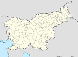
Jesenice
- För andra betydelser, se Jesenice (olika betydelser).
| Jesenice | |
| Assling (tyska) | |
| Stad | |
| Land | |
|---|---|
| Flod | 46°26′11.66″N, 14°3′36.62″E |
| Höjdläge | 576 m ö.h. |
| Koordinater | 46°26′12″N 14°3′36″Ö / 46.43667°N 14.06000°Ö |
| Folkmängd | 13 515 |
| Borgmästare | Tomaz Tom Mencinger |
| Tidszon | CET (UTC+1) |
| - sommartid | CEST (UTC+2) |
| Geonames | 3198647 |
Jesenice är en ort och kommun i norra Slovenien, med 21 945 invånare (30 juni 2008) i hela kommunen.[1] Själva centralorten hade 13 515 invånare i slutet av 2007, på en yta av 8,5 kvadratkilometer.[2]
Geografi
Jesenice är belägen i den övre Krainregionen, i Gorjesavskadalen. Orten är omgiven av bergskedjan Karavanke i norr och av Mežakla i söder; över Karavanke ligger den österrikiska staden Villach. Kurorten Kranjska Gora ligger 15 kilometer nordväst om Jesenice, medan Bled ligger 10 kilometer åt sydost. Andra närliggande orter och städer är Mojstrana, Hrušica och Žirovnica. Byn Planina pod Golico ligger fem kilometer norr om Jesenice. Jesenices klimat är växlande mellan tempererat och inlandsklimat med influenser från bergsklimat.
Källor
- ^ Statistical Office of the Republic of Slovenia, Basic population groups by sex and municipalities
- ^ Statistical Office of the Republic of Slovenia Invånarantal i orter den 31 december 2007.
Externa länkar
Media som används på denna webbplats
The flag of Slovenia.
- "The construction sheet for the coat of arms and flag of the Republic of Slovenia
- is issued in the Official Gazette Uradni list Republike Slovenije #67, 27 October 1994
- as the addendum to the Law on the coat of arms and flag."
Shiny red button/marker widget. Used to mark the location of something such as a tourist attraction.
Författare/Upphovsman: Matija Podhraški sl:Uporabnik:Matijap, Licens: CC BY-SA 3.0
The city Jesenice, Slovenia, from above Žirovnica. In the foreground is the accumulation lake of the hydroelectric power plant Moste.
Författare/Upphovsman: NordNordWest, Licens: CC BY-SA 3.0
Location map of Slovenia


