Jílové u Prahy
| Jílové u Prahy | |||
| Eule | |||
| Stad | |||
| |||
| Land | |||
|---|---|---|---|
| Region | Mellersta Böhmen | ||
| Distrikt | Praha-západ | ||
| Höjdläge | 381 m ö.h. | ||
| Koordinater | 49°53′44″N 14°29′36″Ö / 49.89556°N 14.49333°Ö | ||
| Area | 16,23 km² | ||
| Folkmängd | 4 571 (1 januari 2016)[1] | ||
| Befolkningstäthet | 282 invånare/km² | ||
| Tidszon | CET (UTC+1) | ||
| - sommartid | CEST (UTC+2) | ||
| Postnummer | 254 01 | ||
| Geonames | 3074178 | ||
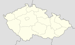
Läge i Tjeckien | |||
Jílové u Prahy (tyska: Eule) är en stad i distriktet Praha-západ i den tjeckiska regionen Mellersta Böhmen. Jílové u Prahy, som för första gången nämns i ett dokument från år 1331, hade 4 571 invånare år 2016.[1]
Referenser
- Den här artikeln är helt eller delvis baserad på material från tyskspråkiga Wikipedia, Jílové u Prahy, 2 juli 2014.
Externa länkar
 Wikimedia Commons har media som rör Jílové u Prahy.
- Jílové u Prahys officiella webbplats
Media som används på denna webbplats
Shiny red button/marker widget. Used to mark the location of something such as a tourist attraction.
Författare/Upphovsman: Honza Groh, Licens: CC BY 3.0
Náměstí v Jílovém u Prahy s radnicí
Författare/Upphovsman: Lencer, Licens: CC BY-SA 3.0
Location map of the Czech Republic


