Interstate 80
| Interstate 80 | |
| Interstate 80 | |
 | |
 | |
| Längd | 4 666 km |
|---|---|
| Byggd | 1956 |
| Västra änden | |
| Huvudavfarter | |
| Östra änden | |
Interstate 80 eller I-80 är en väg, Interstate Highway, i USA. Den börjar i San Francisco och slutar strax väster om New York och räknas därför som en kust-till-kust-väg. På vägen går den genom delstaterna Kalifornien, Nevada, Utah, Wyoming, Nebraska, Iowa, Illinois, Indiana, Ohio, Pennsylvania och New Jersey.
Historia
Motorvägen planerades under Eisenhowers presidenttid i mitten av 1950-talet som en ursprunglig del av Interstate Highway System, det federala motorvägssystemet. Den sista delsträckan i närheten av Salt Lake City invigdes 1986. Vid ceremonin uppmärksammades att platsen ligger nära Promontory Summit i Utah, där den första transamerikanska järnvägen över kontinenten färdigställdes 1869.
Interstate 80 följer den ungefärliga sträckningen för många historiska kommunikationsleder västerut i USA. Delar av motorvägen följer den historiska sträckningen för nybyggarlederna Oregon Trail och California Trail. I västra USA går motorvägen till stora delar parallellt med den första transamerikanska järnvägen som byggdes i slutet av 1860-talet. Den första transkontinentala landsvägen, Lincoln Highway, följde också samma ungefärliga sträckning. Lincoln Highways efterföljare, U.S. Route 30, hade tidigare ungefär samma sträckning som motorvägen innan motorvägen byggdes och är delvis samskyltad med Interstate 80.
Delstater, countyn och städer som vägen går igenom
Vägen går igenom och i närheten av ett antal stora städer på vägen, ungefär längs sträckningen San Francisco – Oakland – Sacramento – Reno, Nevada – Salt Lake City – Cheyenne, Wyoming – Omaha, Nebraska – Des Moines, Iowa – Quad Cities – Chicago – Toledo, Ohio – Cleveland, Ohio – New York. I listan nedan anges vilka kommuner som vägen passerar igenom.
San Francisco

- Richmond
- El Cerrito
- San Pablo
- Pinole
- Hercules
- Davis
- West Sacramento
Sacramento
(inga städer)

(inga städer)
- Fernley
(inga städer)
- Winnemucca
(inga städer)

- Carlin
- Elko
- Wells
- West Wendover
- Wendover

- Salt Lake City
- South Salt Lake
- Wanship
- Coalville
- Laramie
- Buford. I närheten ligger Sherman Summit, ett bergspass som är den högst belägna punkten på Interstate 80.

- Sutherland
- Hershey
- North Platte
- Maxwell
- Brady
- Giltner
- Aurora
- Hampton
- Henderson
- York
- Beaver Crossing
- Goehner
- Milford

- Ashland
- Gretna
Vid Omaha korsar vägen Missourifloden.

- Brighton Township
- Pymosa Township
- Benton Township
- Grant Township
(inga städer)
- Dexter
- Adams Township
- De Soto
- Van Meter
- Waukee
- West Des Moines
- Colfax
- Sherman Township
- Newton
- Buena Vista Township
- Rock Creek Township
- Hartford Township
- Sumner Township
- Williamsburg
- Iowa Township
- Oxford Township
- Tiffin
- Coralville
- Iowa City
- Scott Township
- West Branch
- Springdale Township
- Iowa Township
- Rochester Township
- Sugar Creek Township
- Farmington Township
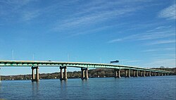
I Scott County passerar vägen genom Quad Cities storstadsområde.
- Cleona Township
- Walcott
- Davenport
- Bettendorf
- Le Claire
Vid Le Claire korsar vägen Mississippifloden.
- Hampton Township
- Moline
- Colona
- Colona Township
- Geneseo
- Atkinson
- Annawan
- Concord Township
- Princeton
- Selby Township
- Ladd
- Erienna Township
- Morris
- Saratoga Township/Aux Sable Township
- Minooka

- Joliet
- Joliet Township
- New Lenox
- Frankfort Township
Interstate 80 passerar söder om Chicago genom Cook County.
- Tinley Park
- Country Club Hills
- Hazel Crest
- East Hazel Crest
- South Holland
- Lansing
- New Durham Township
- Center Township
- South Bend
- Harris Township
- Howe
- Fremont
- York Township

- Northwest Township
- Holiday City
- Brady Township
- Franklin Township
- Dover Township
- Pike Township
- Monclova Township
- Maumee
- Rossford
- Lake Township
- Harris Township
- Sandusky Township
- Riley Township
- Groton Township
- Milan Township
- Brownhelm Township
- Amherst Township
- Elyria Township
- Elyria
- North Ridgeville
- Strongsville
- Broadview Heights

- Richfield
- Boston Heights
- Streetsboro
- Shalersville Township
- Freedom Township
- Braceville Township
- Lordstown
- Jackson Township
- Austintown Township
Trumbull County
- Weathersfield Township
- Girard
- Liberty Township
- Hubbard Township
- Shenango Township
- East Lackawannock Township
- Findley Township
- Worth Township
- Barkeyville
- Clinton Township
- Scrubgrass Township
(inga städer)
På gränsen mellan Butler County och Clarion County korsar vägen Alleghenyfloden.
- Richland Township
- Beaver Township
- Paint Township
- Monroe Township
- Clarion Township
- Union Township
- Brookville
- Pine Creek Township
- Winslow Township
- Sandy Township
- Pine Township
- Plymptonville
- Lawrence Township
- Cooper Township
- Snow Shoe
- Boggs Township
- Spring Township
- Porter Township
- Lamar Township
- Greene Township
- West Buffalo Township
- White Deer Township
- Milton
- East Chillisquaque Township
- Valley Township
- Hemlock Township
- Bloomsburg
- South Centre Township
- Main Township
- Sugarloaf Township
- Butler Township
- White Haven
- Kidder Township
- Tunkhannock Township
- Jackson Township
- Pocono Township
- Hamilton Township
- Stroud Township
- Stroudsburg
- East Stroudsburg
- Delaware Water Gap
På gränsen mellan Pennsylvania och New Jersey korsar I-80 Delawarefloden vid Delaware Water Gap.

- Hardwick Township
- Knowlton Township
- Hope Township
- Allamuchy Township
- Mount Olive Township
- Netcong
- Roxbury Township
- Mount Arlington
- Wharton
- Rockaway Township
- Denville
- Parsippany-Troy Hills
- Montville
- Fairfield Township
- Elmwood Park
- Saddle Brook
- Lodi
- Hackensack
- Teterboro
- Ridgefield Park
- Teaneck
Vägen slutar vid korsningen med New Jersey Turnpike/Interstate 95 i Teaneck strax väster om New York.
Externa länkar
 Wikimedia Commons har media som rör Interstate 80.
| |||||||
Media som används på denna webbplats
600 mm by 600 mm (24 in by 24 in) Interstate shield, made to the specifications of the 2004 edition of Standard Highway Signs (sign M1-1). Uses the Roadgeek 2005 fonts. (United States law does not permit the copyrighting of typeface designs, and the fonts are meant to be copies of a U.S. Government-produced work anyway.) Colors are from [1] (Pantone Red 187 and Blue 294), converted to RGB by [2]. The outside border has a width of 1 (1 mm) and a color of black so it shows up; in reality, signs have no outside border.
Uses the Roadgeek 2005 fonts. (United States law does not permit the copyrighting of typeface designs, and the fonts are meant to be copies of a U.S. Government-produced work anyway.) Colors are from [1] (Pantone Red 187 and Blue 294), converted to RGB by [2]. The outside border has a width of 1 (1 mm) and a color of black so it shows up; in reality, signs have no outside border.
750 mm × 600 mm (30 in × 24 in) U.S. Highway shield, made to the specifications of the 2004 edition of Standard Highway Signs. (Note that there is a missing "J" label on the left side of the diagram.) Uses the Roadgeek 2005 fonts. (United States law does not permit the copyrighting of typeface designs, and the fonts are meant to be copies of a U.S. Government-produced work anyway.)
Författare/Upphovsman: Ken Lund from Reno, Nevada, USA, Licens: CC BY-SA 2.0
Reno is a city in the US state of Nevada. Known as "The Biggest Little City in the World", Reno is famous for its casinos and as the birthplace of Caesars Entertainment Corporation. The city is situated in the northwestern part of the state and is the county seat of Washoe County. Reno is the most populous Nevada city outside of the Las Vegas metropolitan area. As of the 2010 census, the city had a population of 225,221 making it the fourth most populous city in the state after Las Vegas, Henderson, and North Las Vegas. The city sits in a high desert at the foot of the Sierra Nevada and its downtown area (along with Sparks) occupies a valley informally known as the Truckee Meadows.
Reno is part of the Reno–Sparks metropolitan area which consists of all of both Washoe and Storey counties and has a 2013 estimated population of 437,673. making it the second largest metropolitan area in Nevada.
en.wikipedia.org/wiki/Reno,_Nevada
en.wikipedia.org/wiki/Wikipedia:Text_of_Creative_Commons_...Författare/Upphovsman: Famartin, Licens: CC BY-SA 4.0
View east along Interstates 80 and 90 crossing from York Township, Steuben County, Indiana (on the Indiana Toll Road) to Northwest Township, Williams County, Ohio (on the Ohio Turnpike)
Författare/Upphovsman: Famartin, Licens: CC BY-SA 4.0
Gate and cones blocking the main lanes of Interstate 80 during a late spring snowstorm at Exit 370 in Archer, Laramie County, Wyoming
(c) Crispy1995 på engelska Wikipedia, CC BY-SA 3.0
Overhead sign at the east end of I-80 near NYC.
(c) Coolcaesar from en.wikipedia.org, CC BY-SA 3.0
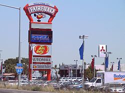
A sign next to northbound Interstate 80 which welcomes visitors to Fairfield. Photographed on July 24, 2006 by user Coolcaesar.
Författare/Upphovsman: daveynin from United States, Licens: CC BY 2.0
Cuyahoga Valley overlooking I-80 Ohio Turnpike
Författare/Upphovsman: Famartin, Licens: CC BY-SA 4.0
View south-southwest down Maverick Canyon, Nevada and west along Interstate 80 from the cliffs on the east end of the north wall
Författare/Upphovsman: jetzenpolis, Licens: CC BY 2.0
Interstate 80 approaching the Des Plaines River Bridge from the east in Joliet.
Författare/Upphovsman: user:Coolcaesar, Licens: CC BY-SA 3.0
The interchange of Interstate 80 with U.S. Highway 101 in San Francisco. This is where Interstate 80 starts or ends, depending upon which way one is traveling.
Författare/Upphovsman: Nicholas from Pennsylvania, USA, Licens: CC BY 2.0
Interstate 80, western Iowa.
(c) http://www.cgpgrey.com, CC BY 2.0
road trip, the west, rocky mountains, interstate highway system
Författare/Upphovsman: Hanyou23, Licens: CC BY-SA 4.0
Photo of Lincoln, Nebraska, USA; as seen from the Nebraska Highway 103 interchange overpass at Interstate 80, in Seward County, Nebraska. Photo is looking nearly due east and slightly southeast towards downtown Lincoln. The Nebraska State Capitol Building can be seen just right of center and downtown Lincoln to the left of the capitol.
Författare/Upphovsman: Famartin, Licens: CC BY-SA 4.0
View east towards Interstate 80's interchange with Interstate 215 and beyond towards downtown Salt Lake City, Utah from an airplane taking off from Salt Lake City International Airport
Författare/Upphovsman: Hanyou23, Licens: CC BY-SA 4.0
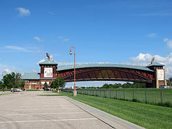
Photo of the Great Platte River Road Archway Monument; as seen from the parking lot to the west (south of E. 1st Street) in Kearney, Nebraska. Photo is looking east-southeast towards the west side of the archway. Interstate 80 can be seen just above the fence line from the bottom-left of center to the bottom right of this photo.
600 mm by 600 mm (24 in by 24 in) Interstate shield, made to the specifications of the 2004 edition of Standard Highway Signs (sign M1-1). Uses the Roadgeek 2005 fonts. (United States law does not permit the copyrighting of typeface designs, and the fonts are meant to be copies of a U.S. Government-produced work anyway.) Colors are from [1] (Pantone Red 187 and Blue 294), converted to RGB by [2]. The outside border has a width of 1 (1 mm) and a color of black so it shows up; in reality, signs have no outside border.
Författare/Upphovsman: Nicholas A. Tonelli from Pennsylvania, USA, Licens: CC BY 2.0
Interstate 80, Delaware Water Gap, as seen from a lookout on Mount Minsi, Pennsylvania. The highway straddles the New Jersey side of the Gap.
